[a5] in.con.gru.ous
UNFOLDING THE PROCESS
Group 1: go [BIG]
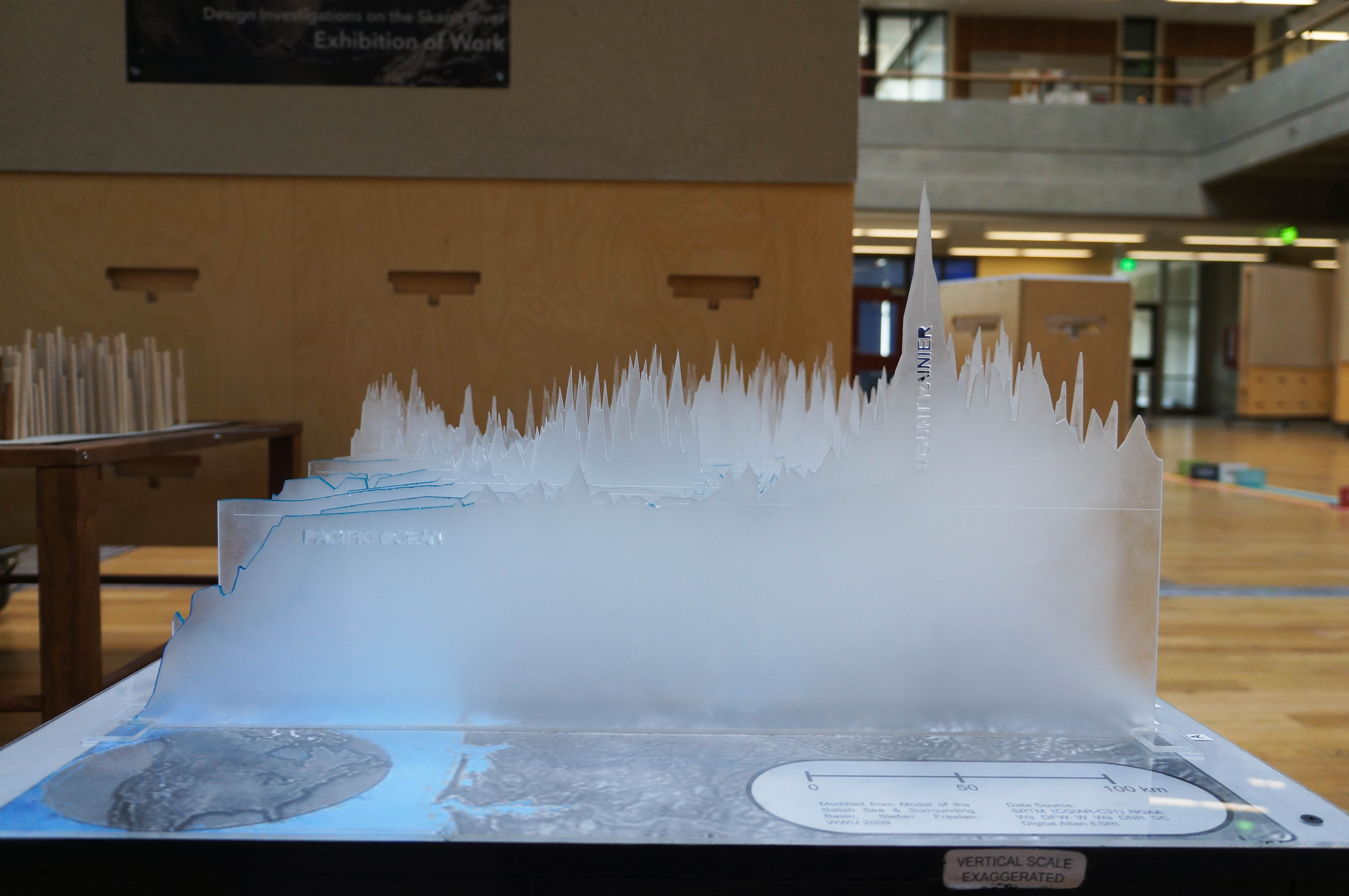
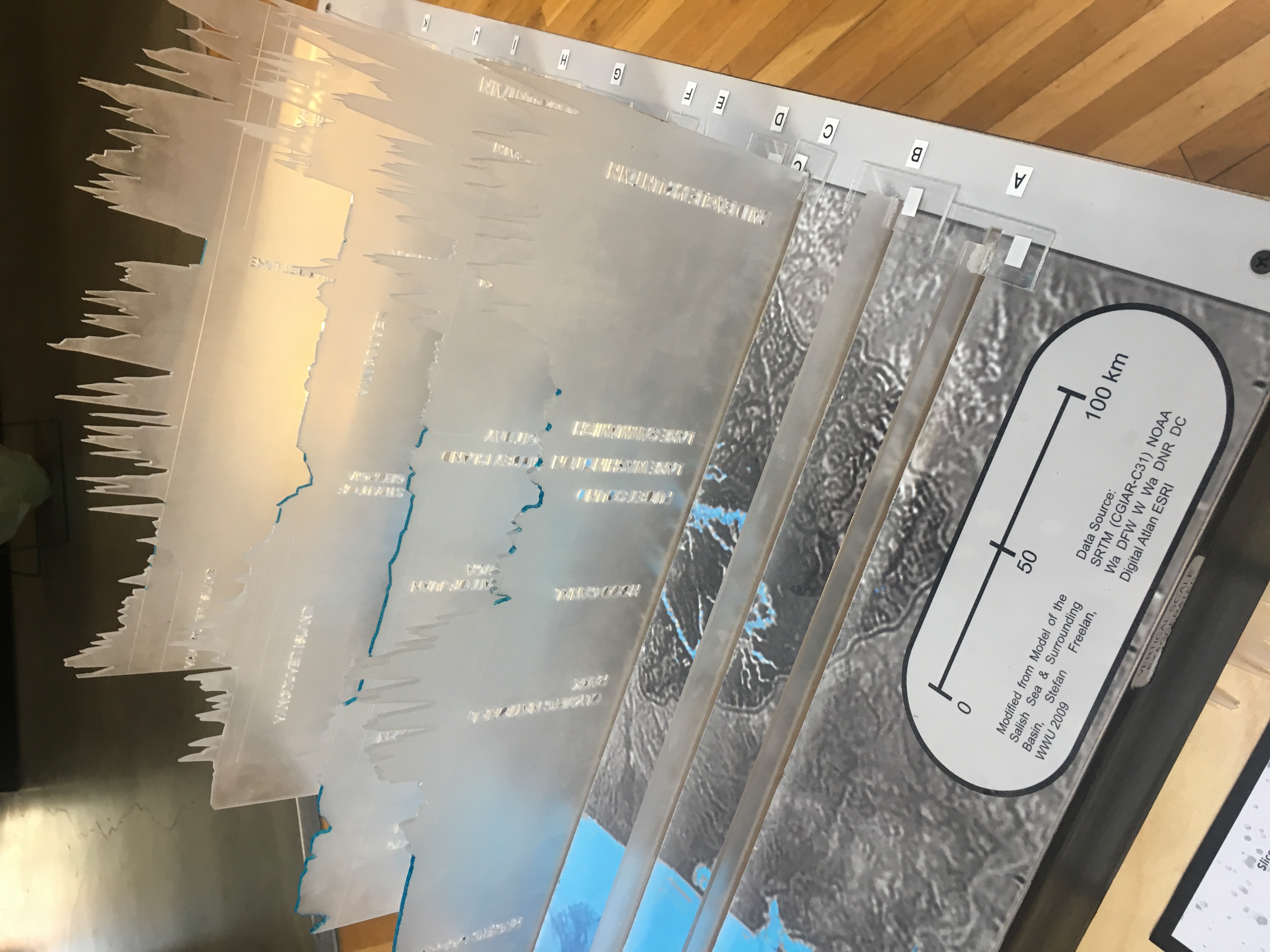
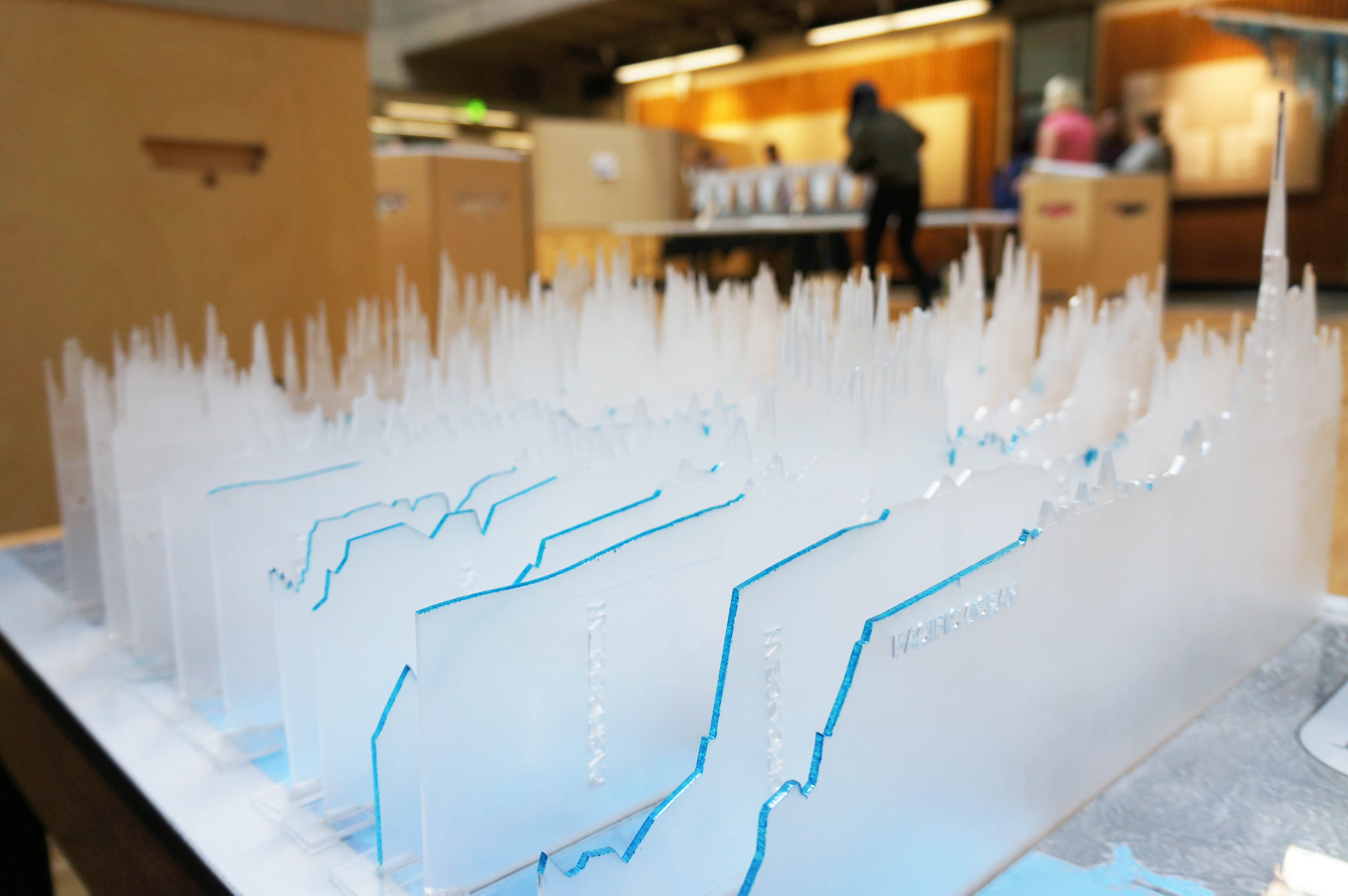
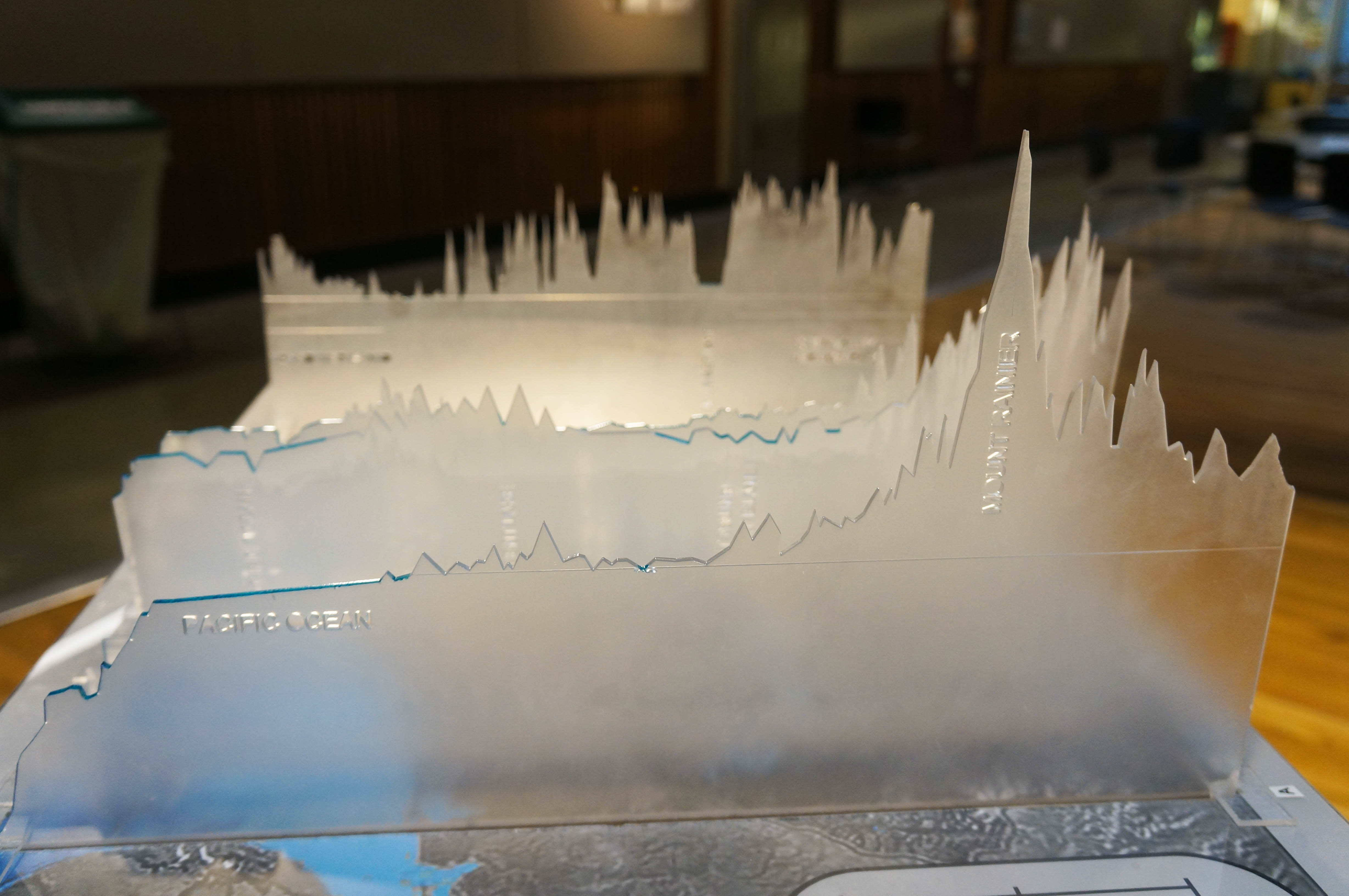
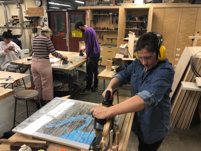
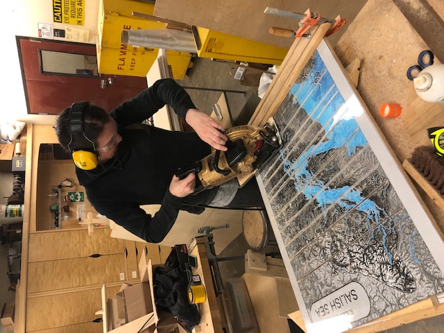
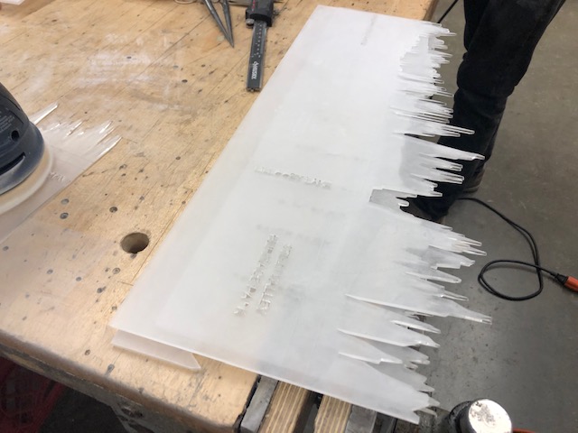
Slices of the Salish Sea
Carved by glaciers this project investigates, from mountains to Sound, the topographic variability of the region. The sections of the Salish Sea are cut at points that have significant topographical features to show the differentiation of the landscape. This is an interactive model which allows for the user to become intimate with a specific slice of the landscape while being able to view the broader landscape of the Salish Sea as a whole. This model creates a juxtaposition between 2D sections into a 3D model by extruding the lines of the landscape to create a dynamic system of elevations that frame the Salish Sea.
Group 2: Liquid Lands
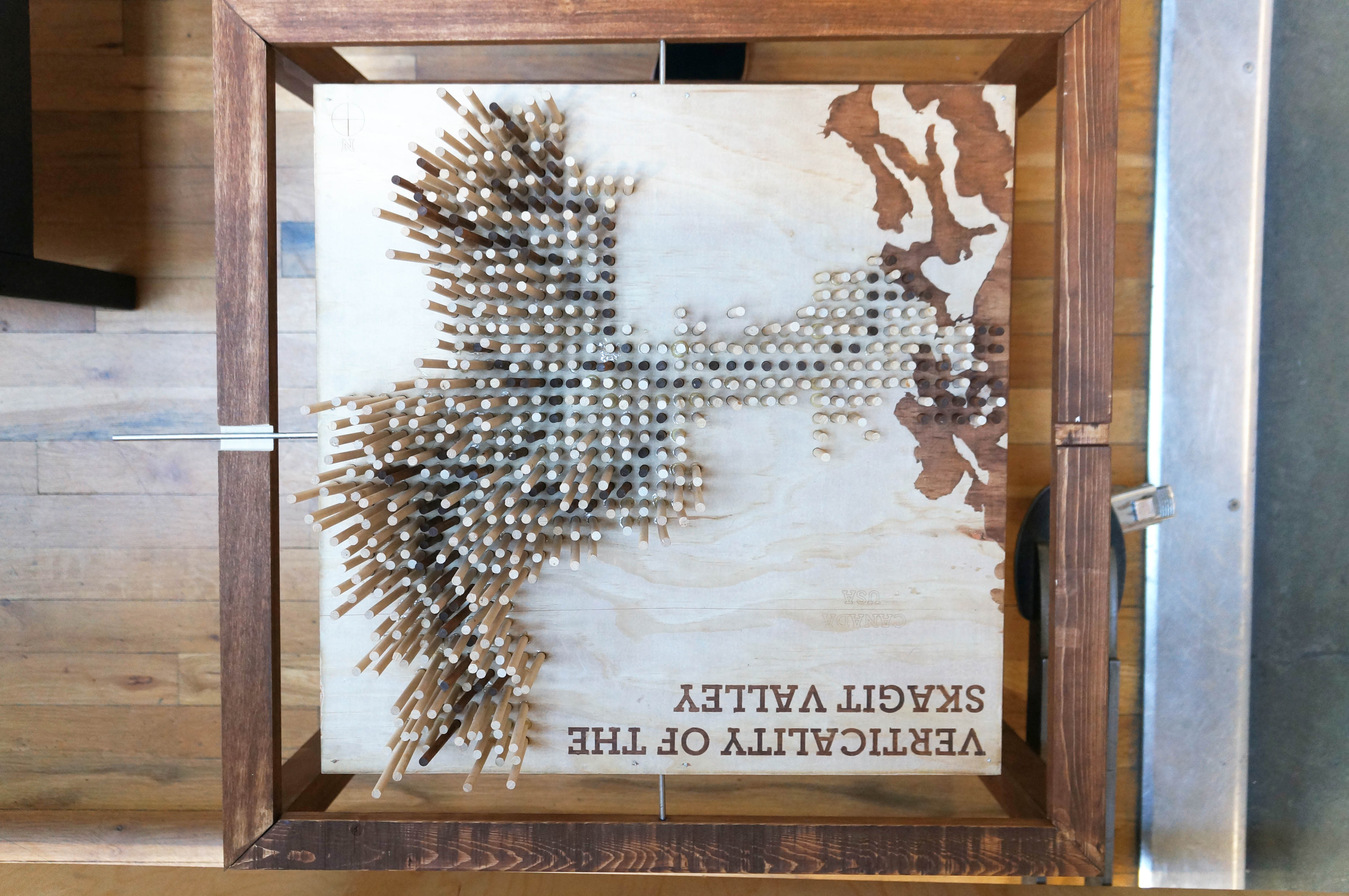
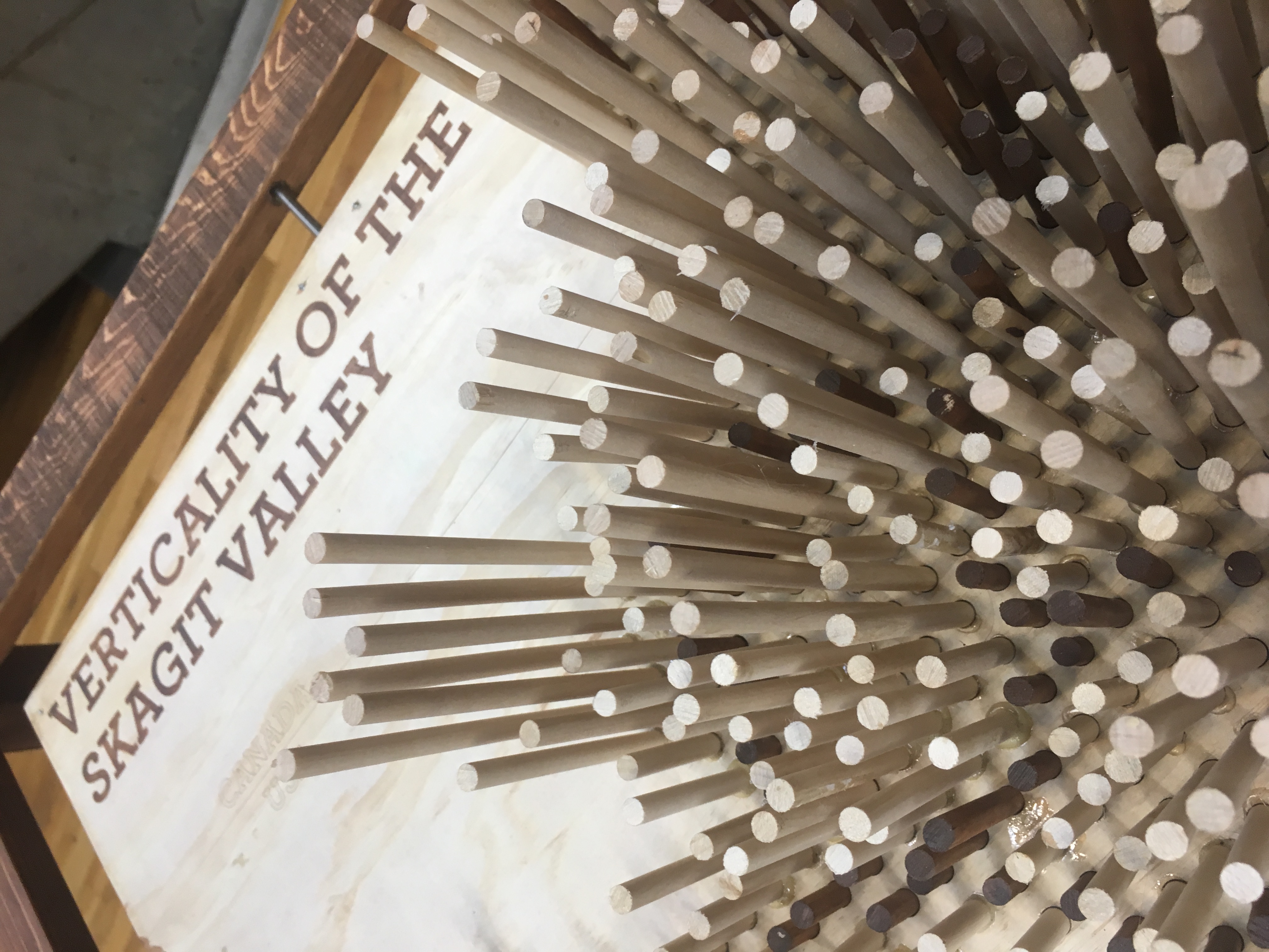
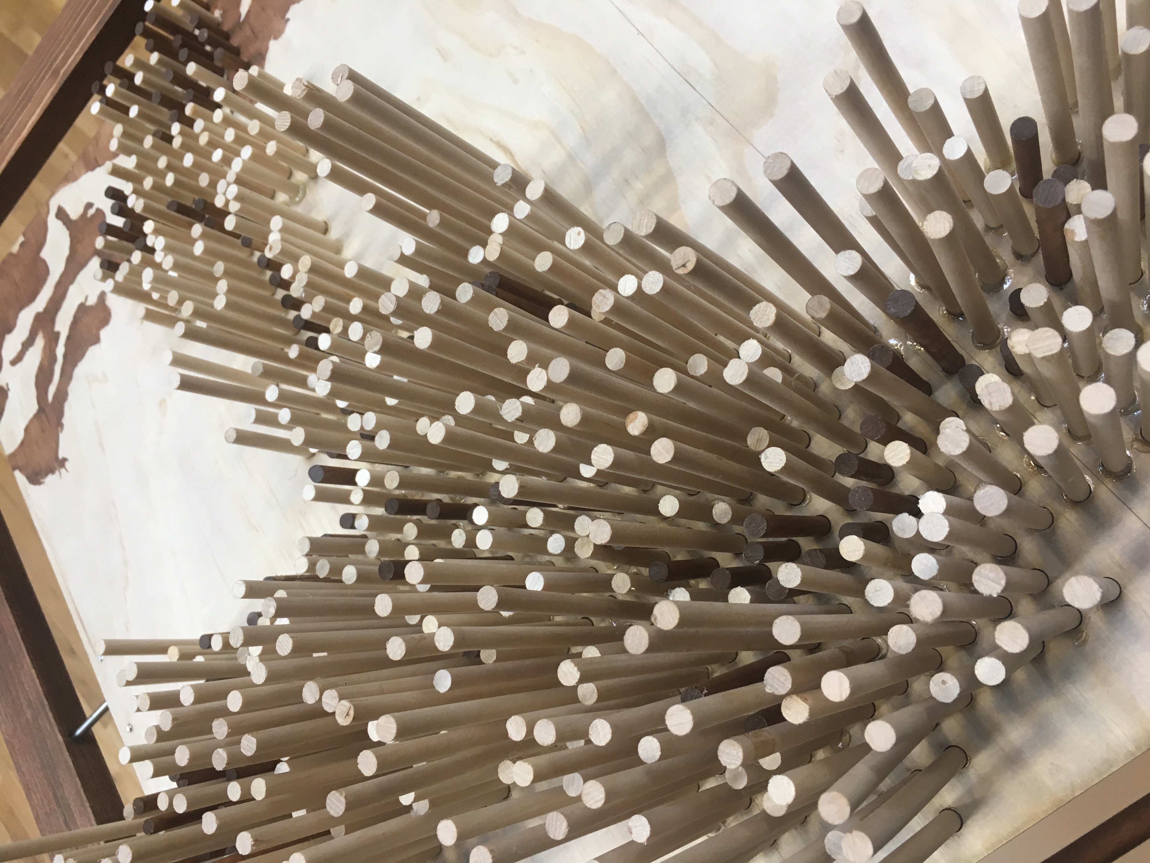
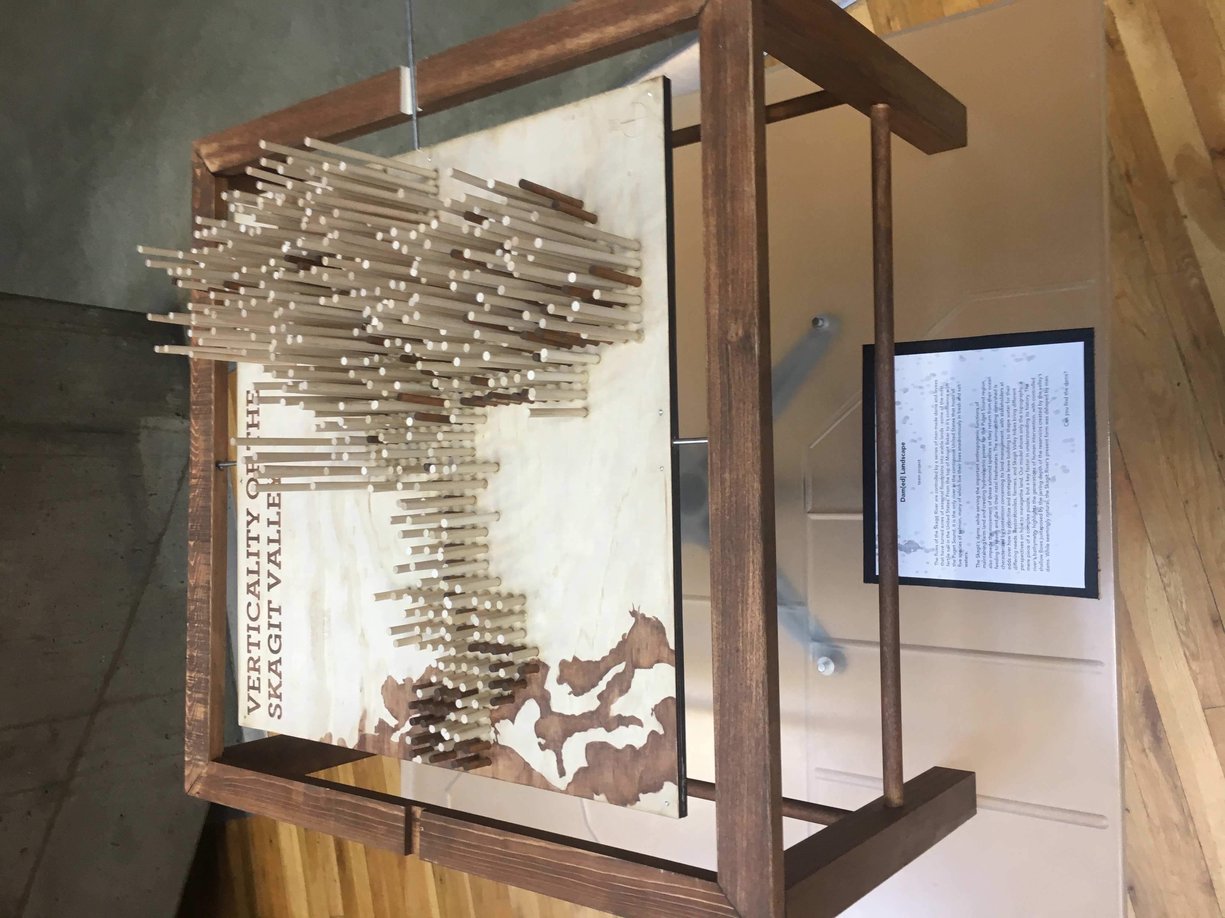
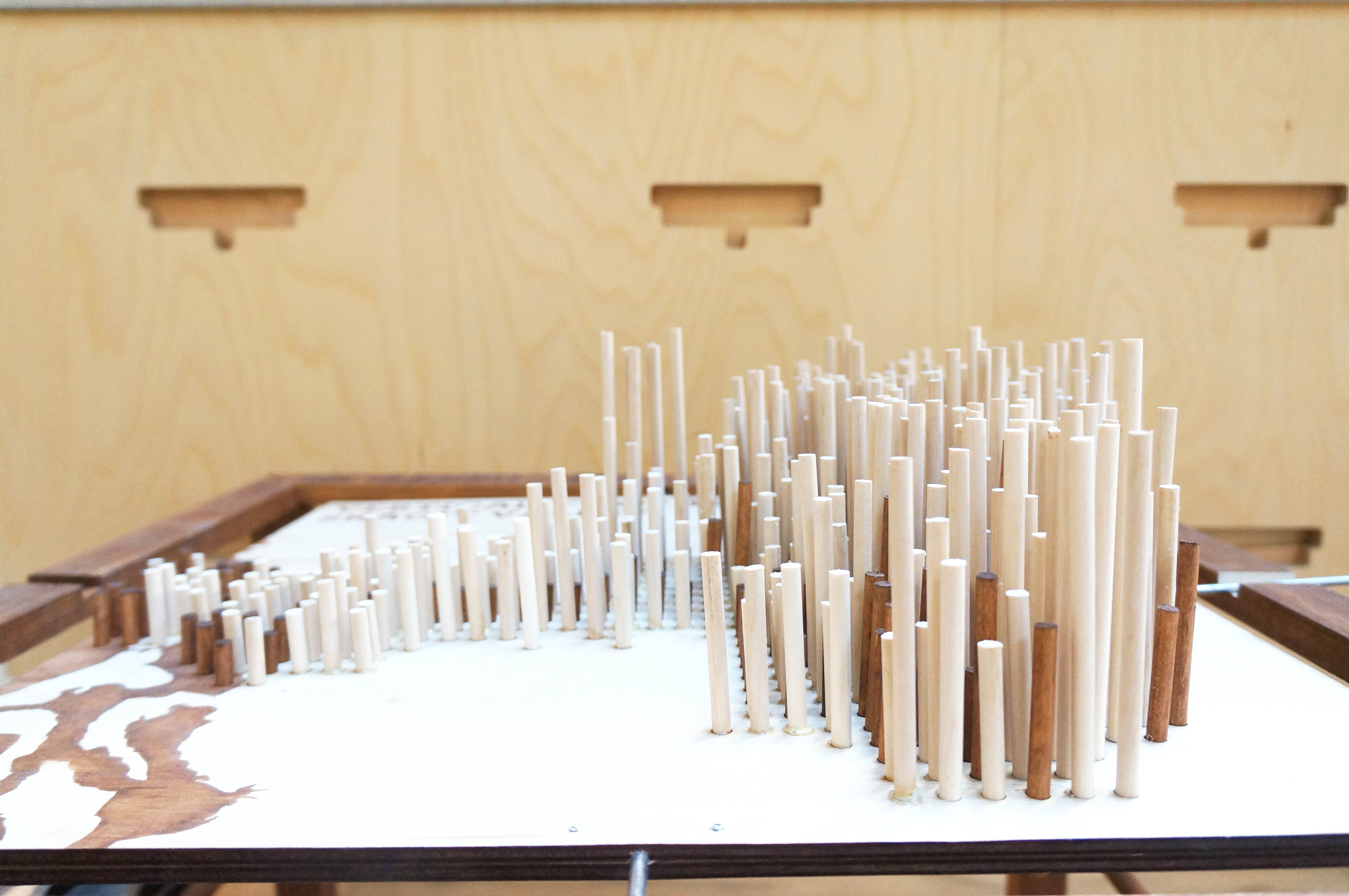
Verticality of the Skagit
The Skagit Watershed is characterized by a series of man made dams and levees that have turned acres of seasonal floodplains into arable lands – some of the most fertile soil in the United States. From the top of Mount Baker to its basin in the Puget Sound, the Skagit River winds its course. It is the only river in the contiguous United States that hosts all five species of salmon, many of which live their lives anadromously in fresh and salt waters. The Skagit’s dams, while serving the important anthropogenic functions of maintaining farm land and creating hydroelectric power for the Puget Sound region, also impede the movement of these salmonidae species as they return from their ocean feeding to spawn in their natal freshwaters.
The Skagit Valley is characterized, too, by contention around its land management, with stakeholders at odds over how to prioritize and strategize levee building to shape water for their differing needs. Restorationists, farmers, and Skagit Valley tribes bring different perspectives on how to move forward managing the land. Our model shows only the topography, a mere piece of a complex puzzle, but a key factor in understanding its history. The river’s bathymetry highlights the generations of human intervention, with controlled shallow flows juxtaposed by the jarring depth of the reservoirs created by the valley’s dams. While seemingly natural, the Skagit River’s present form was shaped by man.
Can you find the dams?