[a6] founding
ENDURING EXISTENCE
problem statement
flood, fix, repeat
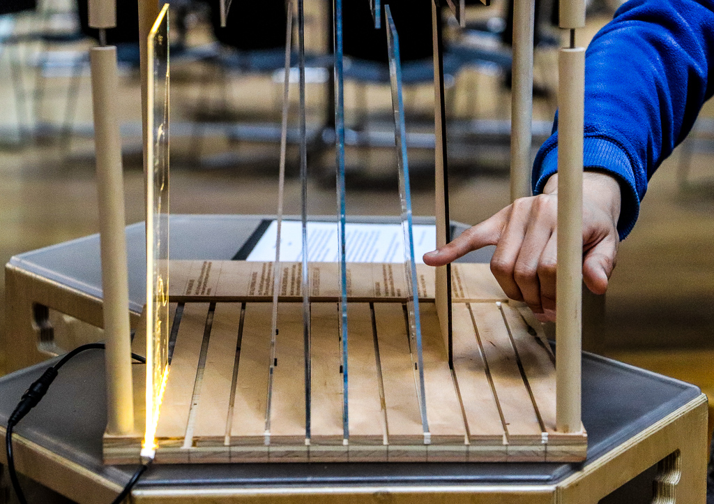
“Long ago, floods were described as Acts of God. Today, these are known quite often to be consequences of the acts of man” (Ian McHarg, 1964). This project explores the historic connection between flooding and colonial intervention within the Skagit River Valley, with the goal of uncovering whether or not human intervention has been successful in reducing the magnitude and frequency of the valley’s flood events, or if the permanent alternations of the Skagit River are resulting in the inverse affect. While humans have been shaping the landscape of the Skagit Valley for centuries, this exploration begins with the arrival of European settlers, and covers a time period where colonial culture and natural systems are struggling to co-exist.
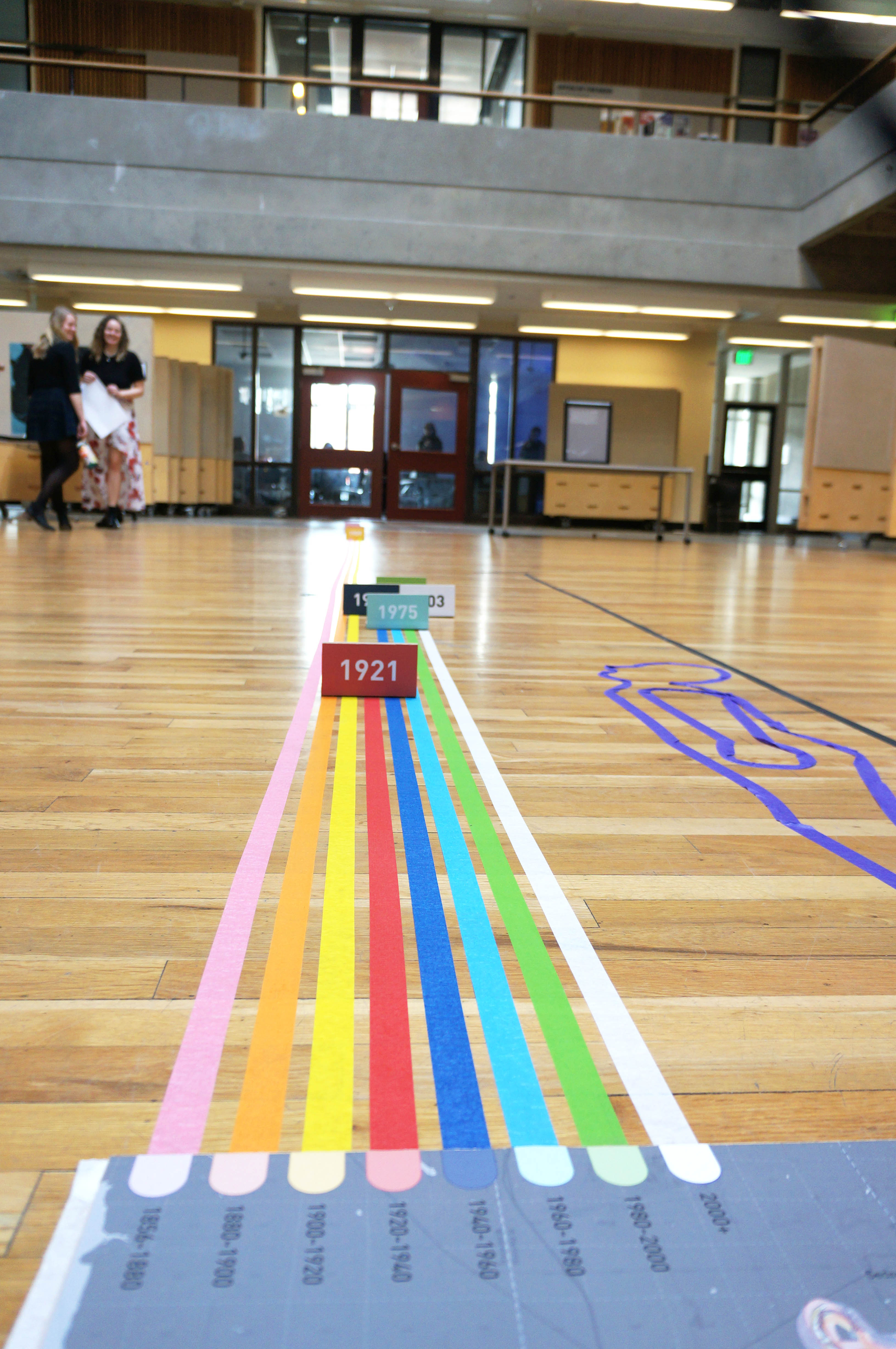
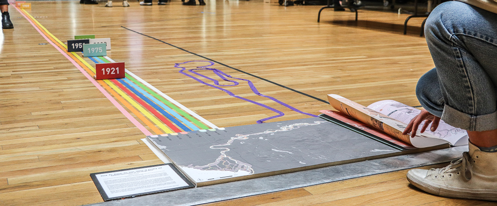
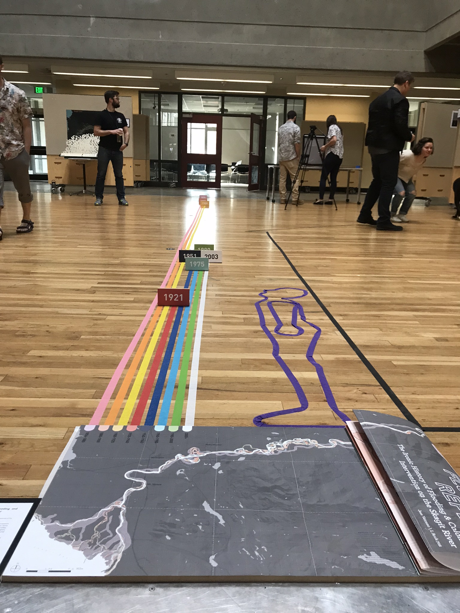
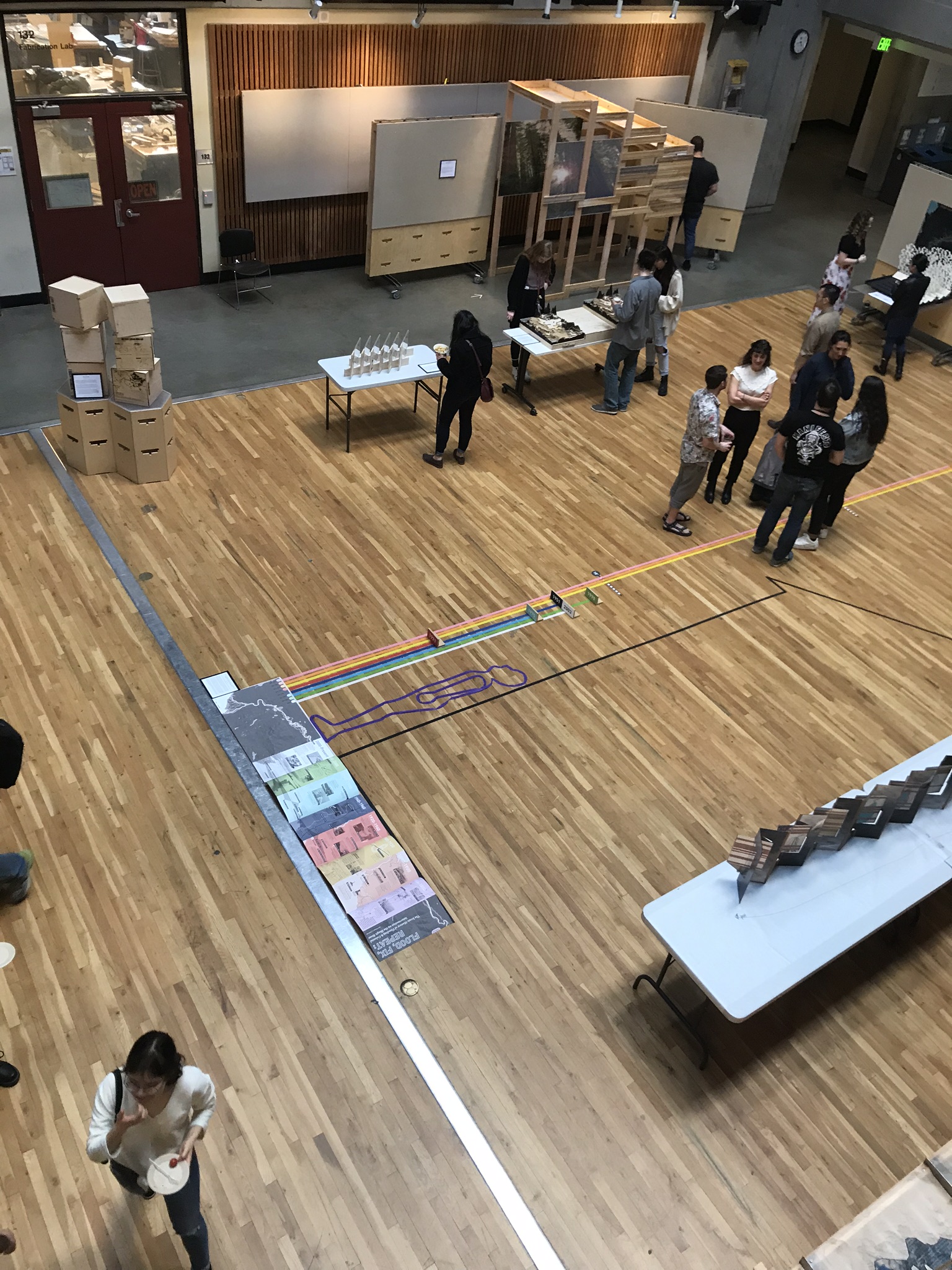
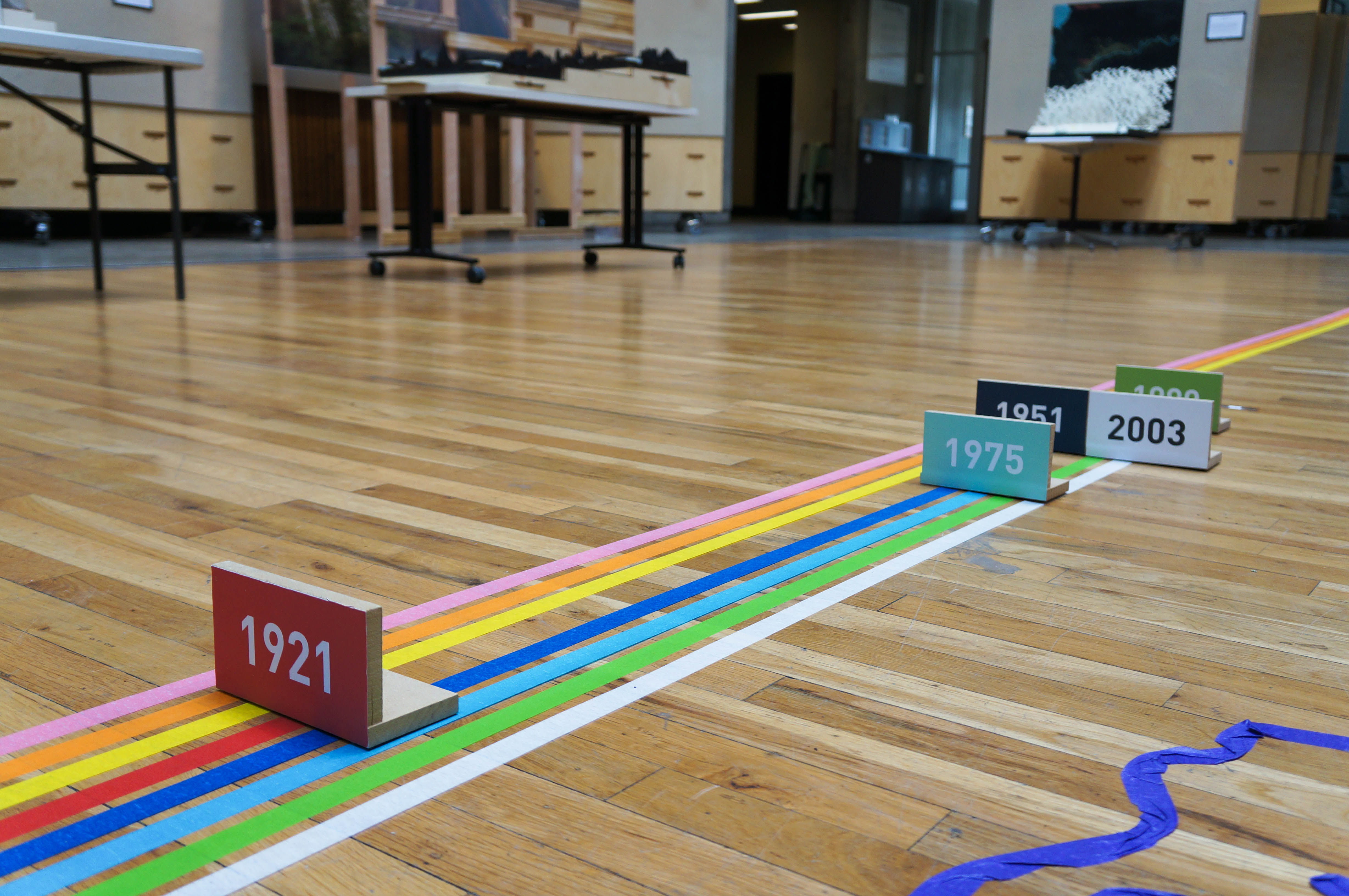
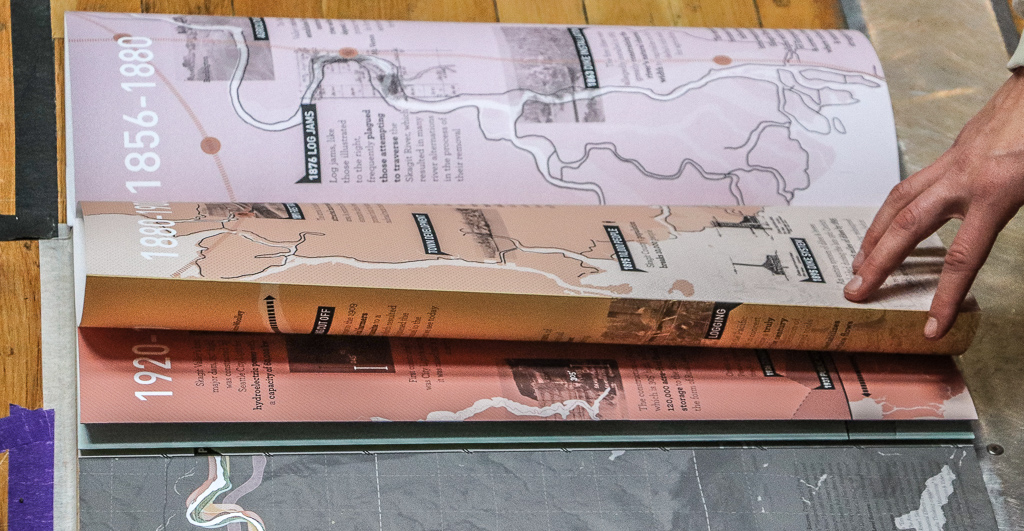
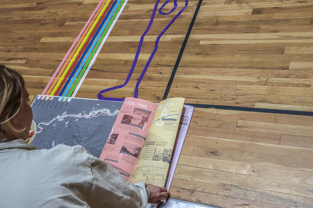
Attempting to move beyond stereotypical representations of time, three different visual typologies are utilized to display these eight intertwined eras of social and natural histories. The full-scale magnitude of each era’s highest flood is taped out on the ground on the y-axis, and together begin to highlight how the magnitudes of floods affecting Skagit Valley have evolved over the past 150 years. The silhouettes of a human figure and a two-story home are included to help make these depths relatable. The x-axis contains an interactive and illustrative narrative of colonial activities that have affected the form of the Skagit River. While separated into distinct eras, it is important to notice how these human activities don’t exist in isolation, spanning multiple eras or causing future activities.
These two datums are grounded in a visual display of the historic migration of the Skagit River channel, which lies at the origin of this project. The three representations together help illustrate a river system that is altered and defined by the two seemingly disconnected activities of flooding and human intervention.
materials: Paper, tape, plywood
a delta in flux

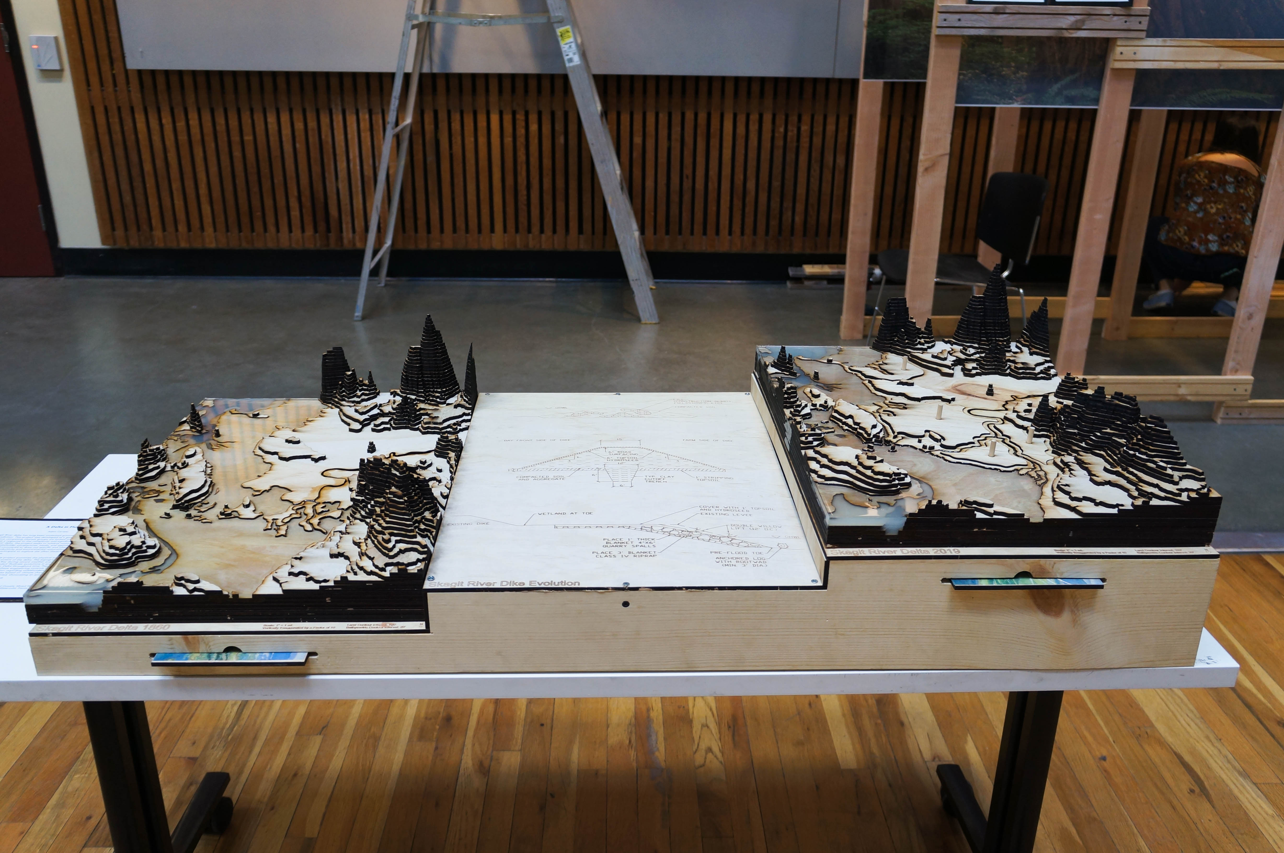
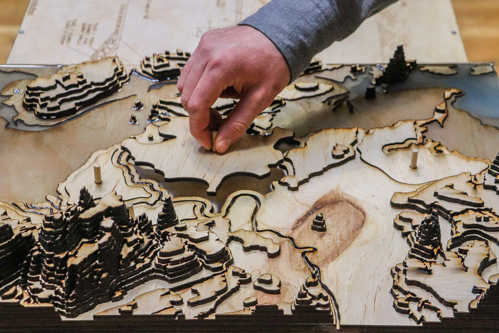
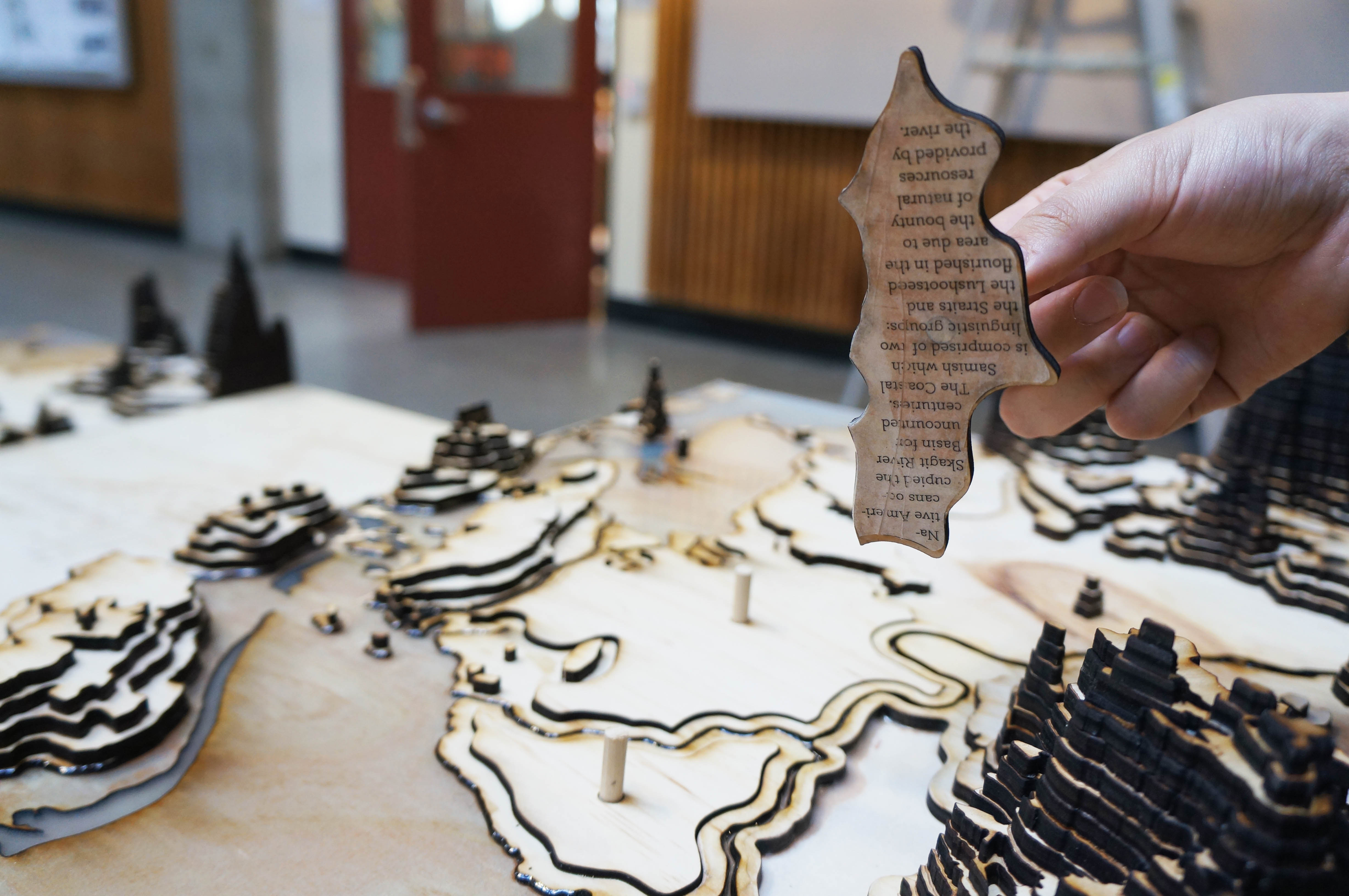
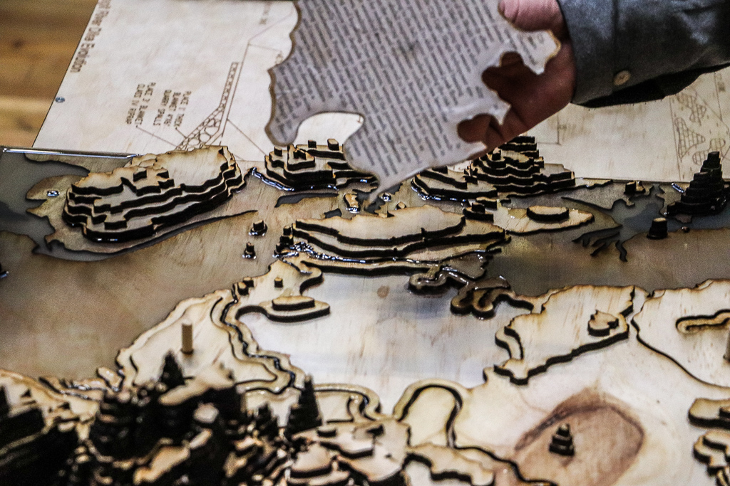
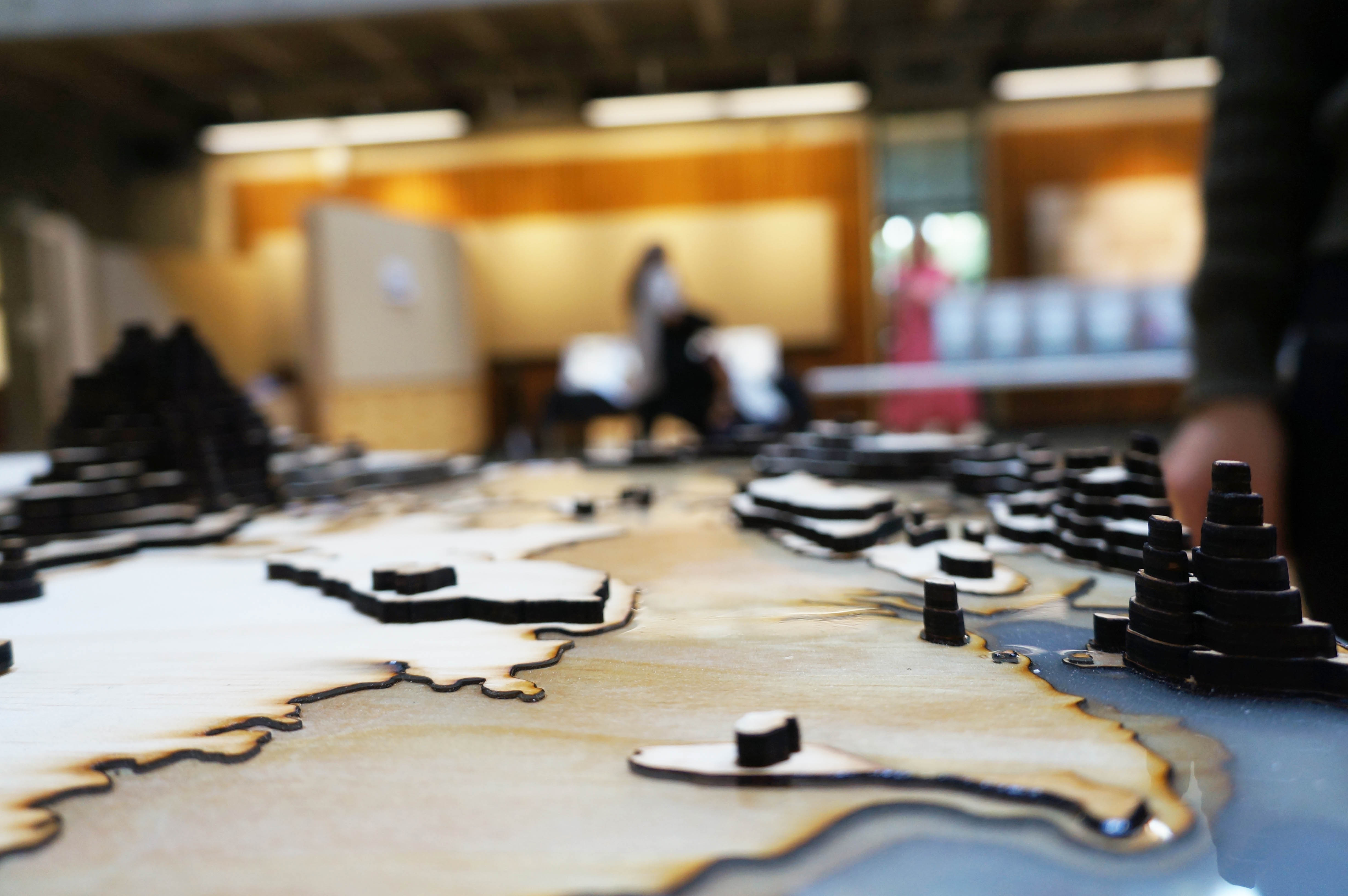
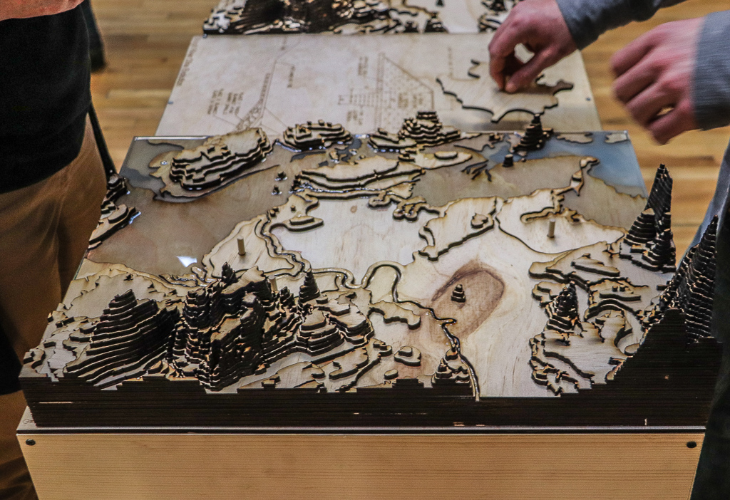
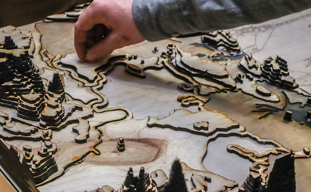
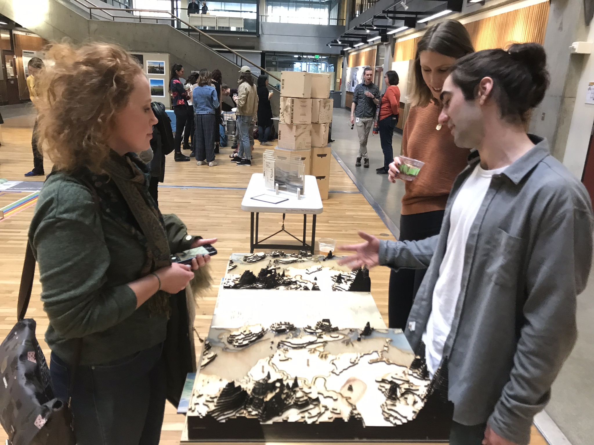
The Skagit River delta is and has been a contested territory. Today, various competing interest groups are concerned with climate change and threats to individual health and wellbeing. These groups range from Indigenous tribes, agriculturalists, restorationists, local officials, climate scientists and local communities. The model is structured in a linear manor to illustrate the changes that have occurred to the delta. The topographic models depict the possible tidal inundation from Skagit Bay during severe weather events. The engraved sections within the center of the base model illustrate evolutions in engineering measures that shaped the Skagit River delta throughout time. Puzzle pieces from the 2019 model can be removed to depict where these engineering measured have taken place. Underneath the puzzle pieces is information regarding stakeholders, temporal shifts in ecology, and future projections for the area based upon climate change predictions. Additionally, plates from the base can be removed, showcasing an artistic representation of the Skagit River delta during that time period.
This piece was developed as a game-board; a shared surface where various competing interest groups are invited to discuss and settle differences (Corner). Developed as a response to the complexity and significance of the many issues facing the Skagit River delta, the model aids in assisting conflicted interest groups come together to achieve common ground by separating multiple issues and agendas. Certain pieces and components of the model can be removed and uncovered to draw out specific thematic conditions (agriculture, restoration, etc.). The alteration of the model allows the participant to explore the interacting nature of the urban theatre (Corner).
materials: plywood, wood dowels, mixed whitewoods, table top epoxy + hardener, blue liquid urethane colorant, watercolor paints, trace paper, wood + tacky glue
future memories
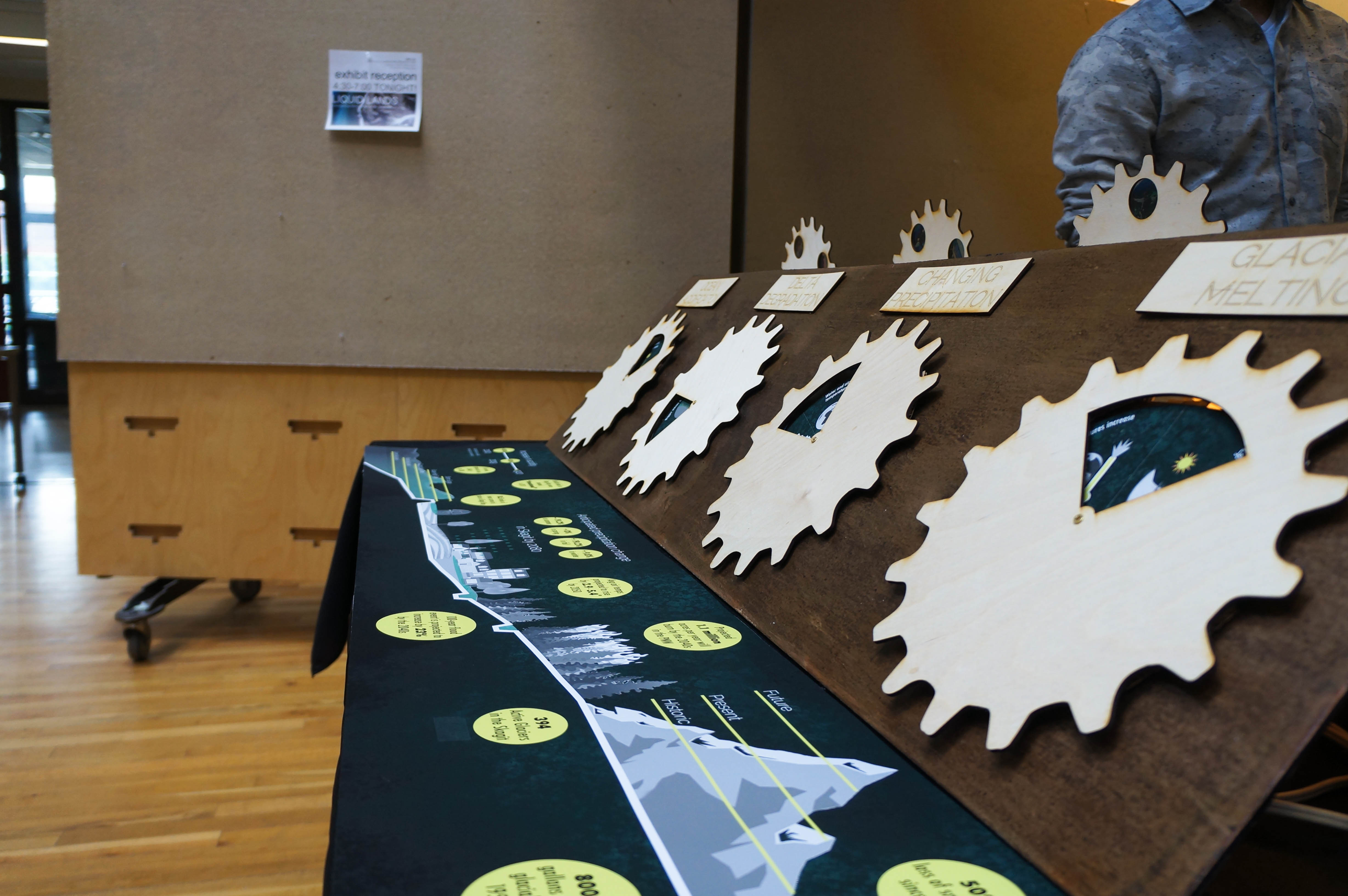
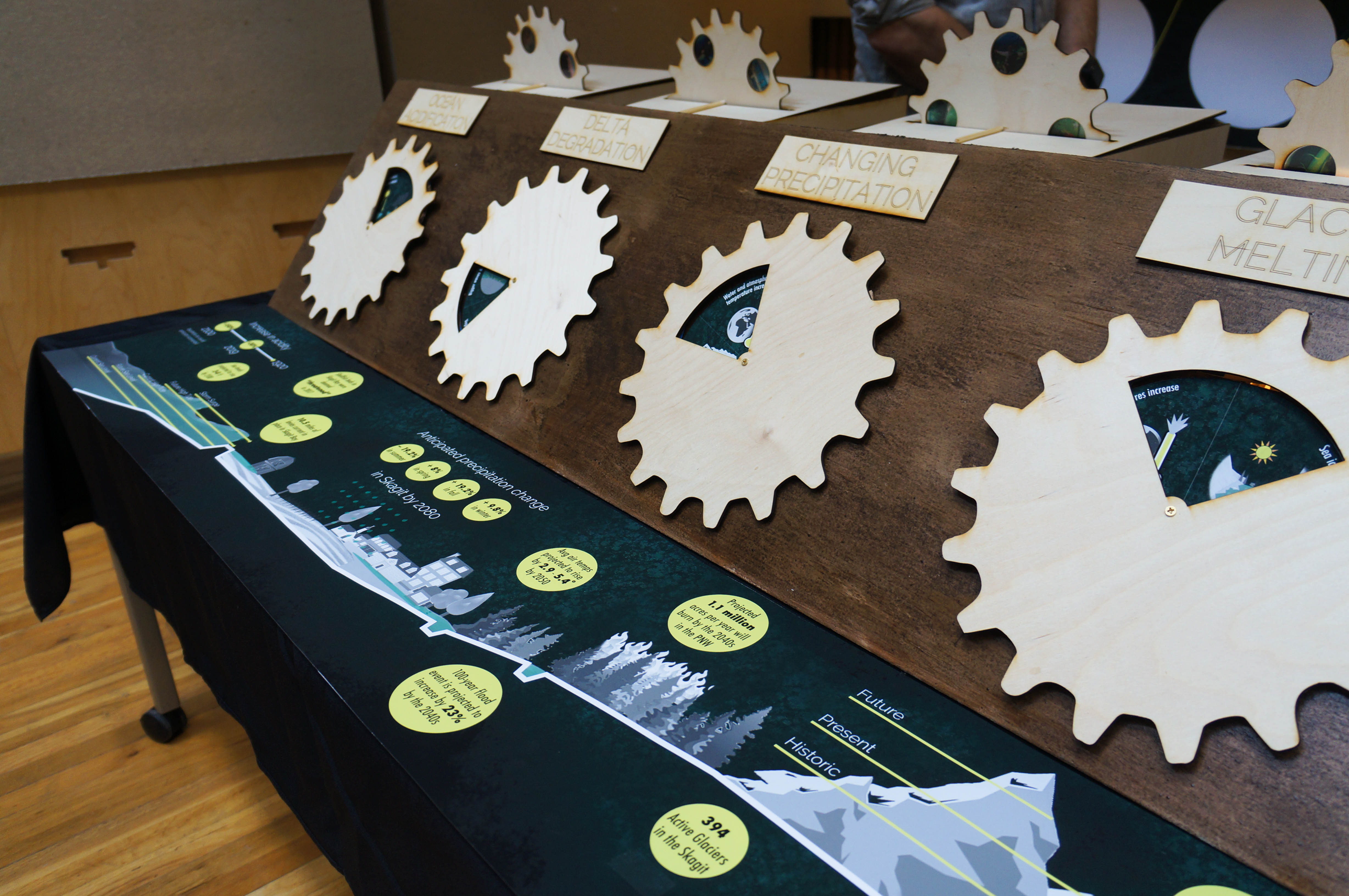
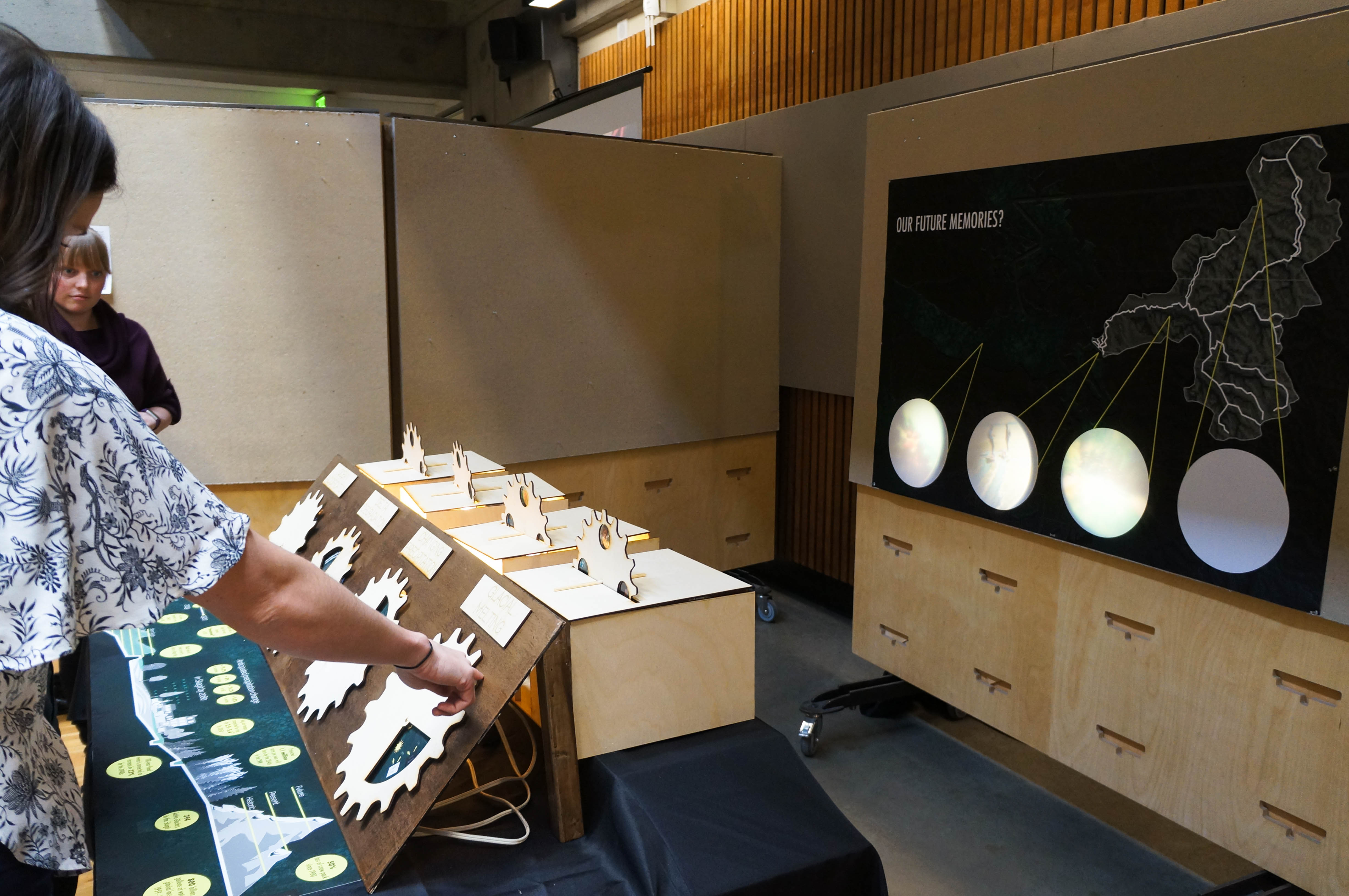

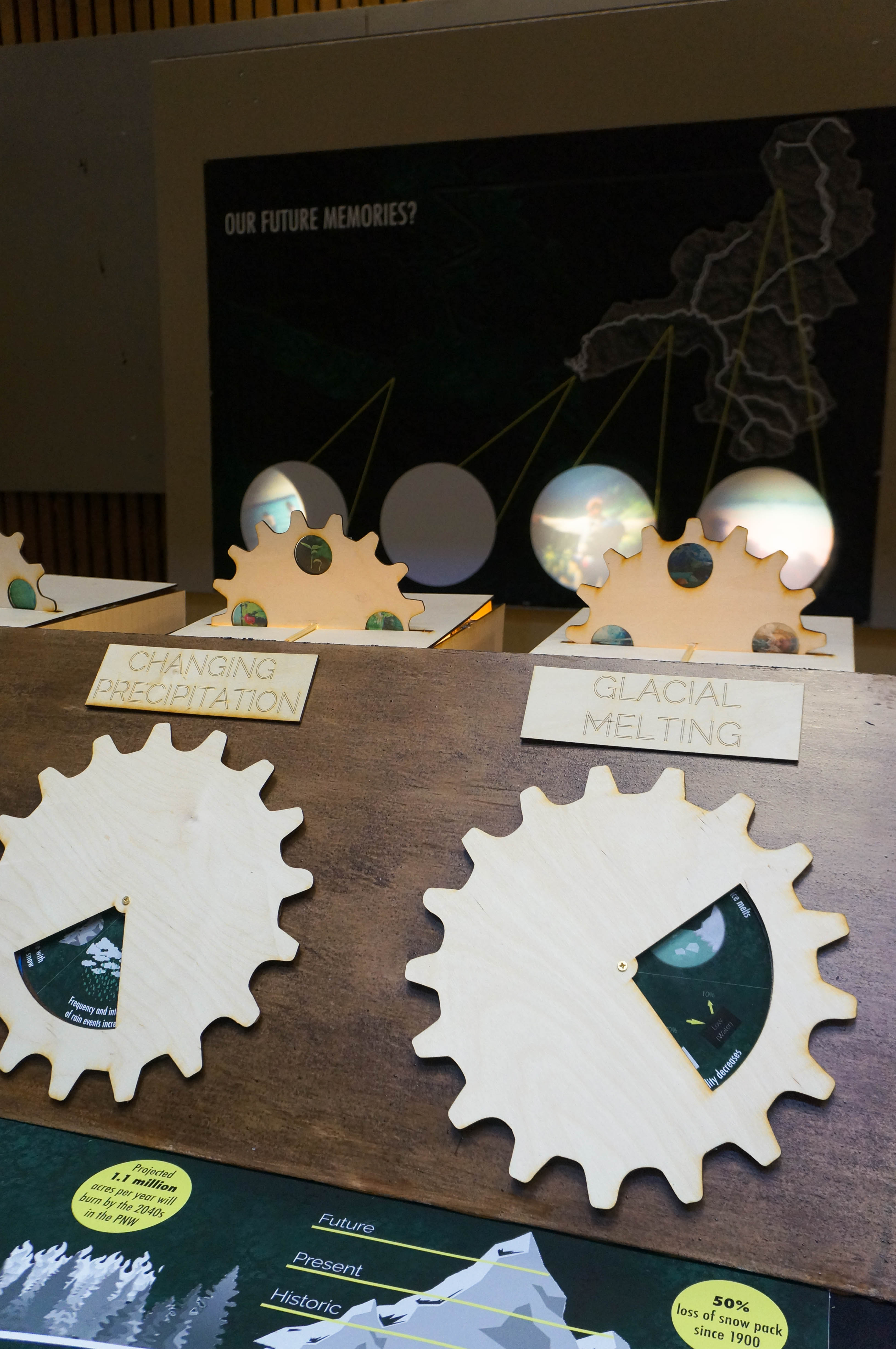
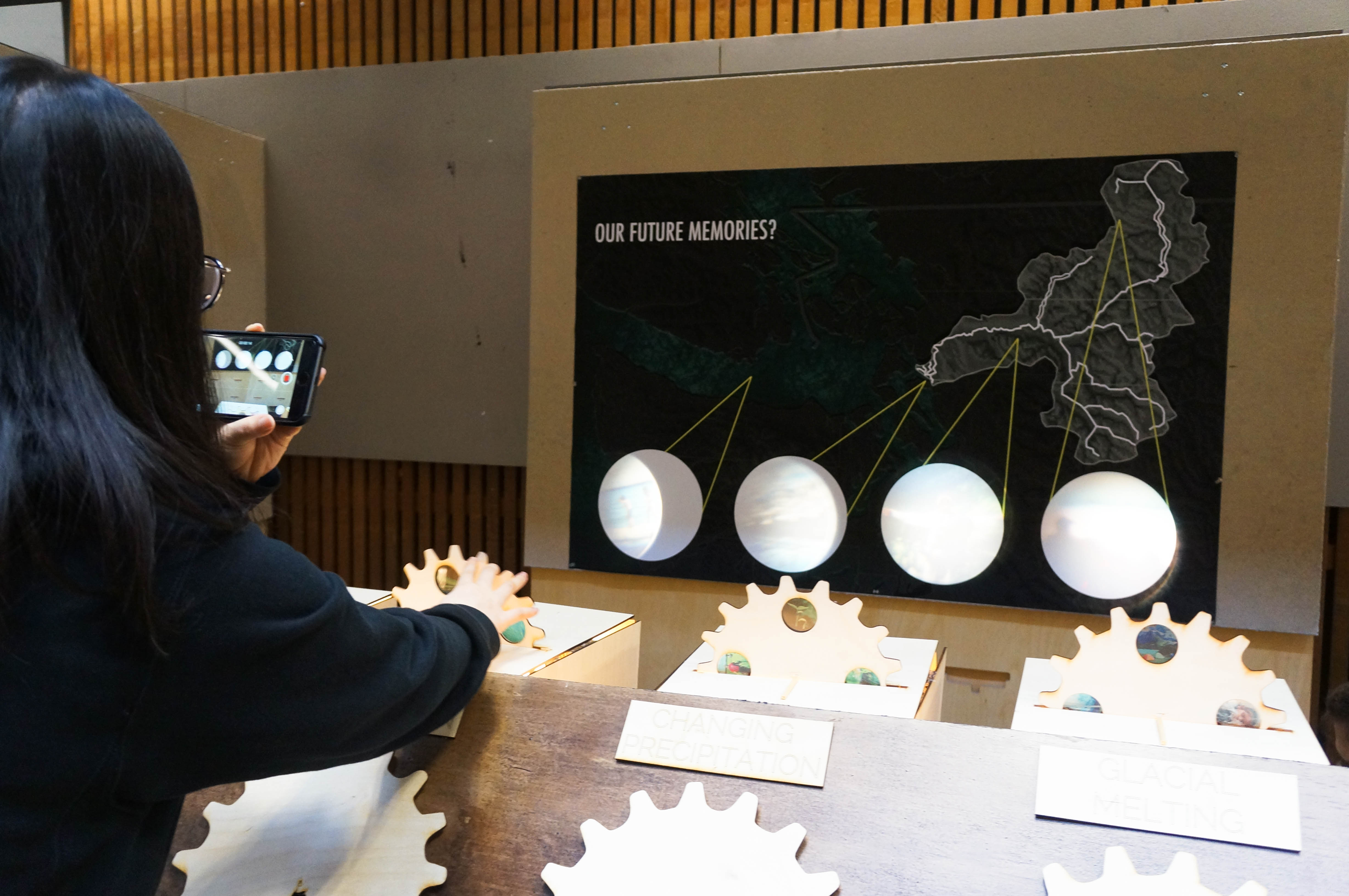
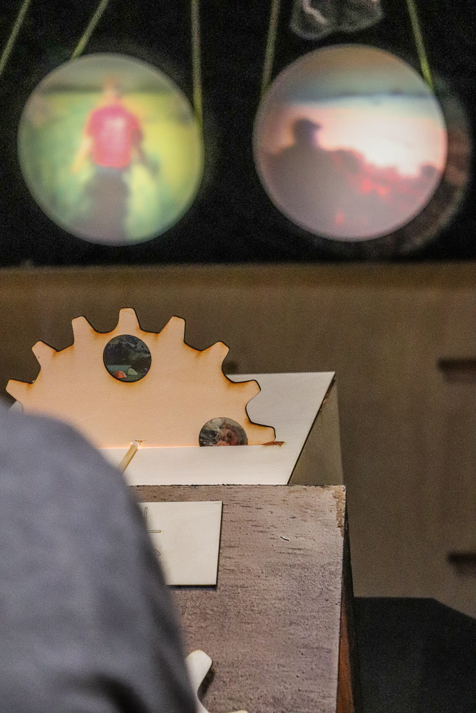
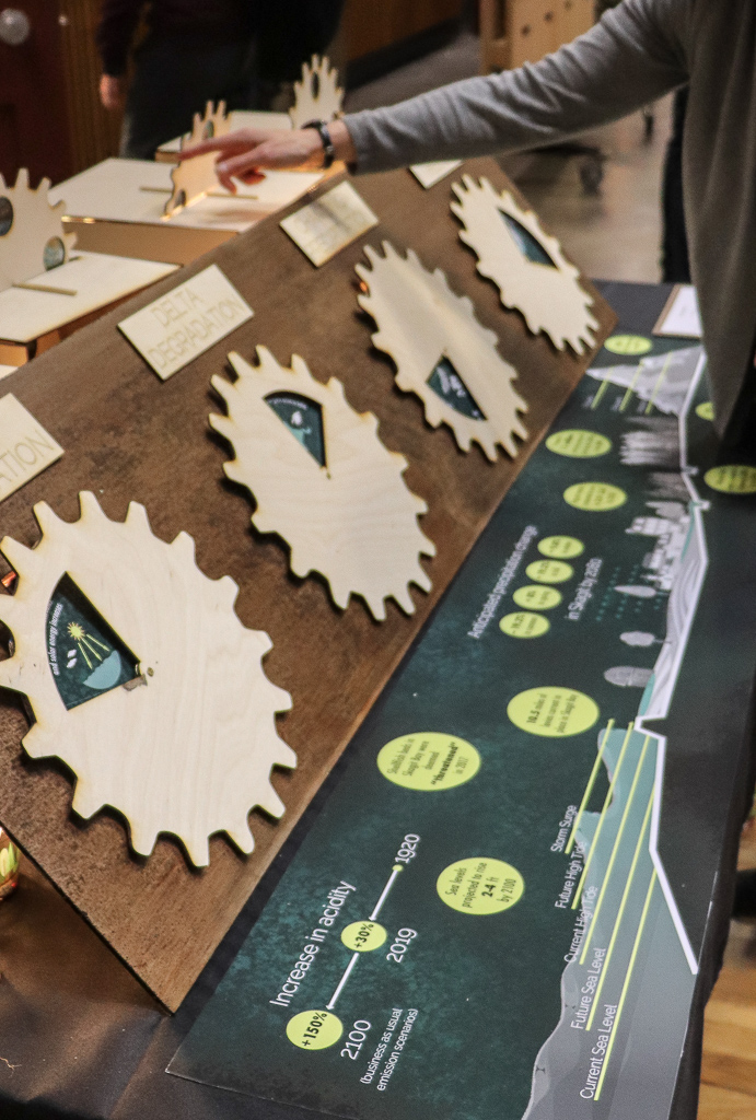
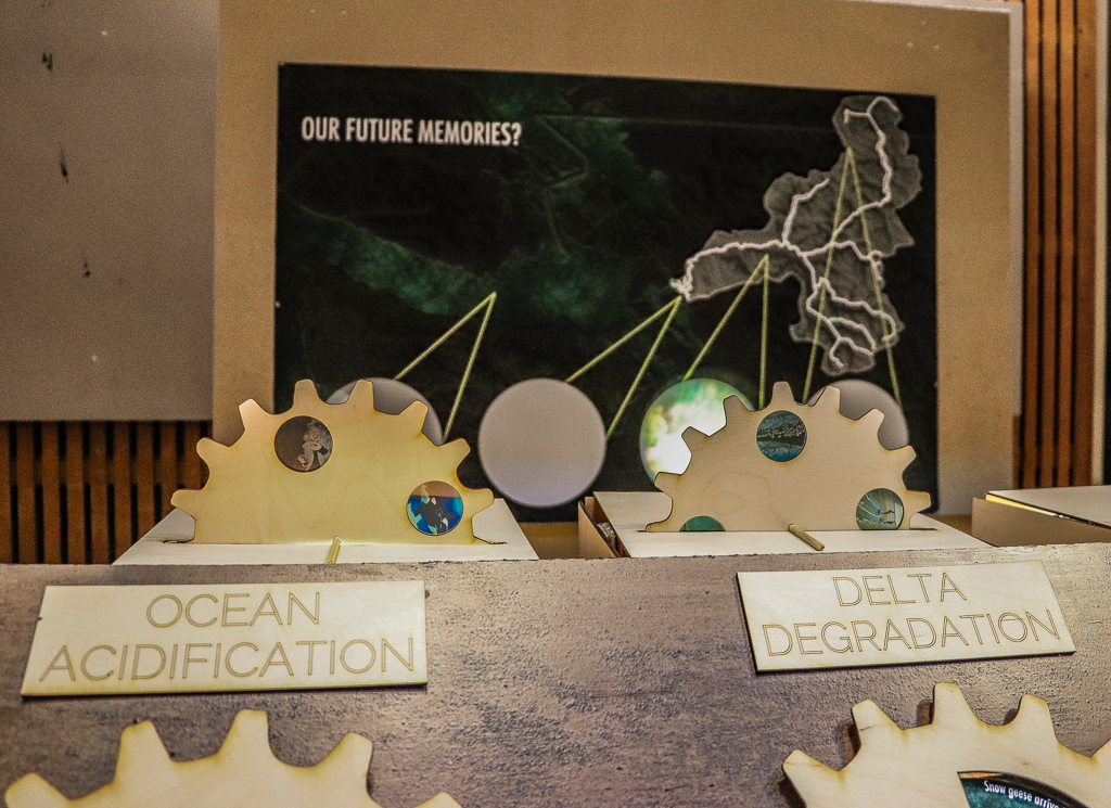
When we begin to dive into the issue of climate change, we quickly find ourselves immersed in an overwhelming problem. Many that attempt to understand the complex processes at play often experience a sense of dread and even disassociation due to the lack of personal connection to such a global problem. In doing so, are we disengaging our emotional responses which ultimately motivate us to change our behavior? This project started by asking the following question; how can we begin to dive into the narrative of climate change and attach ourselves to the specific stories, dramas, and memories that will move us to act?
“Future Memories” attempts to challenge the way we look at, experience, and portray the processes of climate change. Using the Skagit Watershed as it’s canvas, the exhibit enables its viewers to participate in a layered experience engaging both the mind and the heart. As we learn about the direct impacts of glacial melting, changing precipitation, delta degradation, and ocean acidification in the watershed, we are constantly interrupted by memories and experiences that may be threatened by these developments. These projections are displayed with a sense of ephemerality through the use of light and projection to emphasize the fragile nature of our landscapes. They flicker on and off much like the memories we hold in our minds. As we explore the exhibit, we can begin to see some of the segmented and intertwined processes that are occurring, the stories that are in motion, and our potential future memories.
materials: gloss paper, birch wood, cedar wood, light, magnifying glass, transparent paper
migration devastation
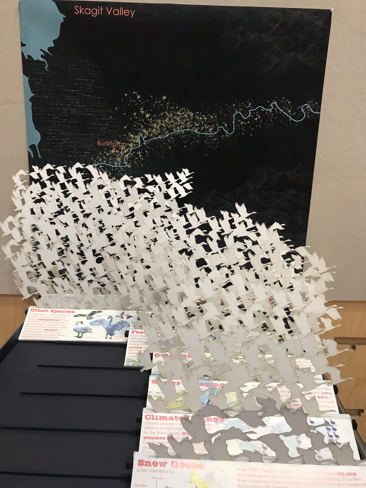
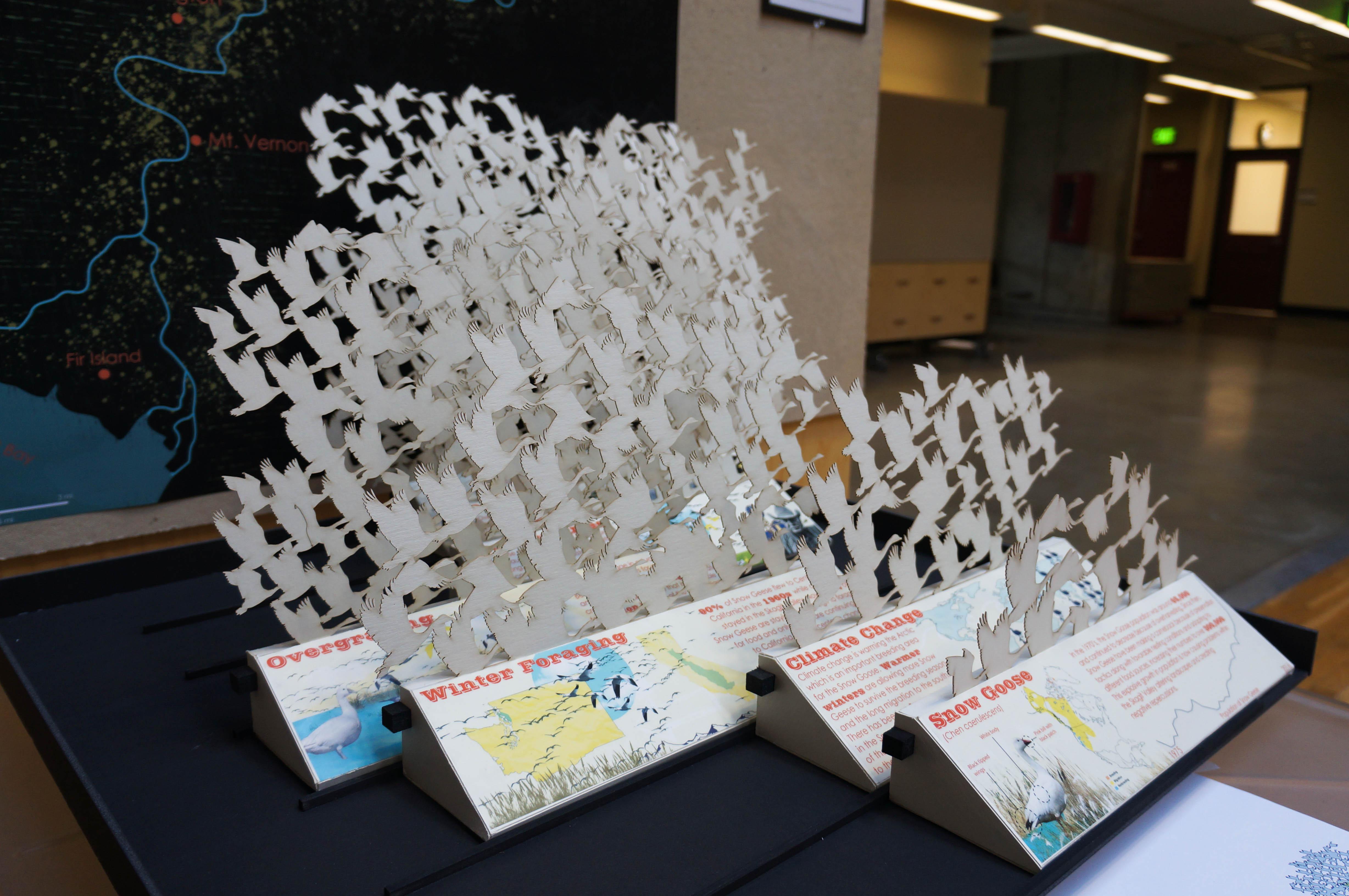
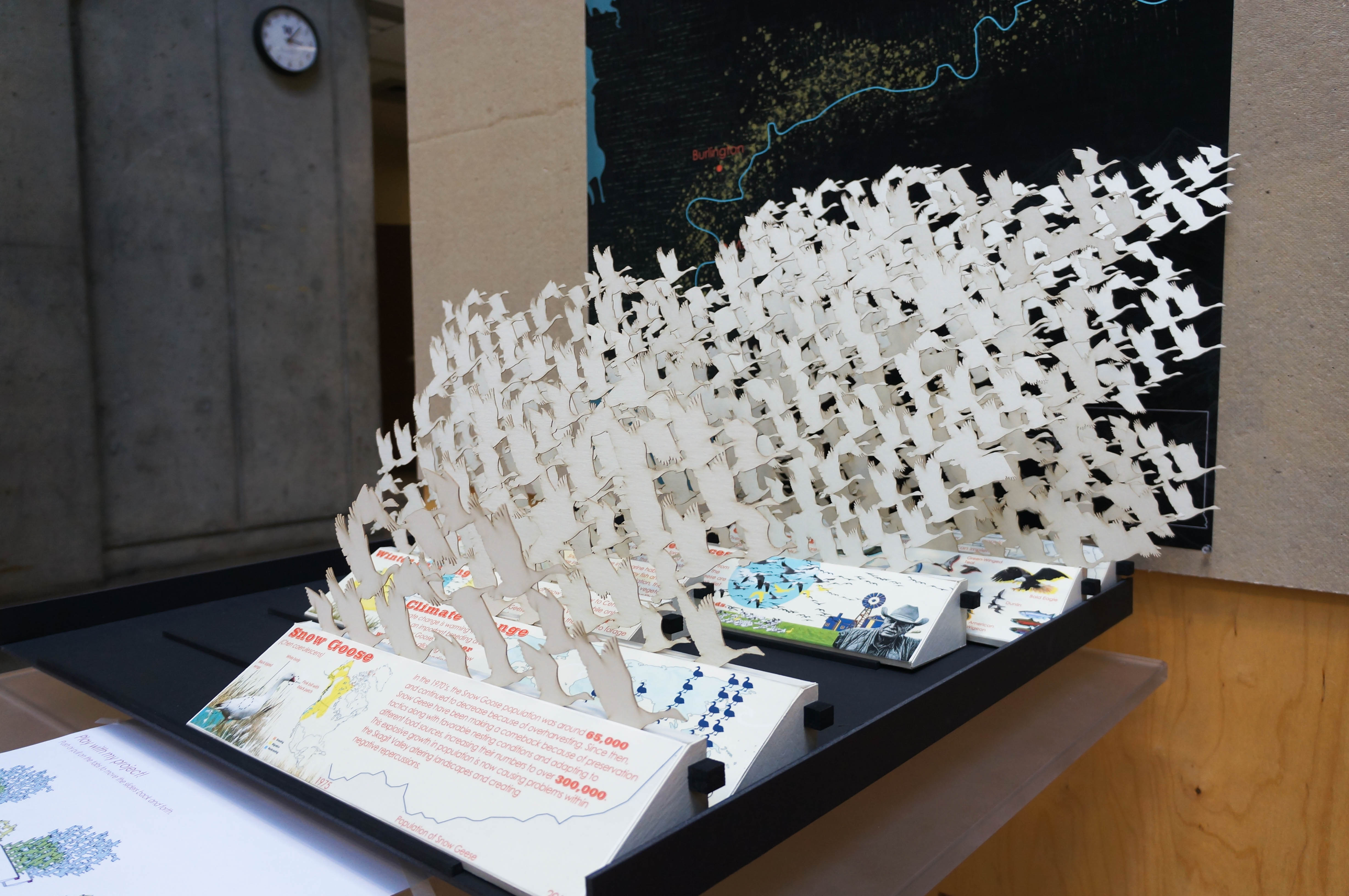
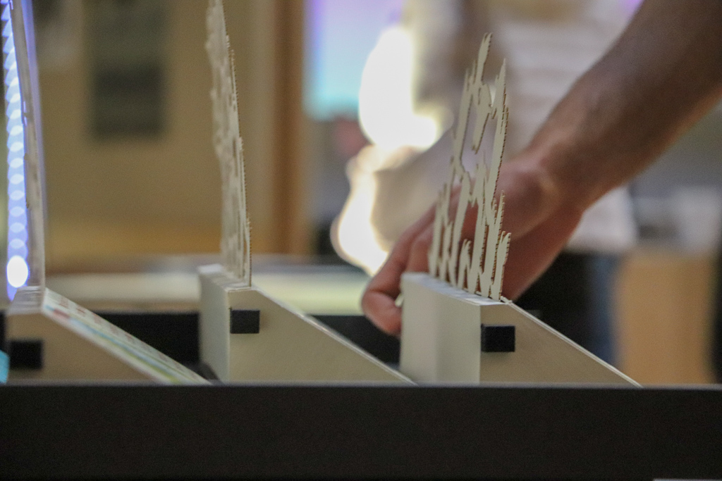
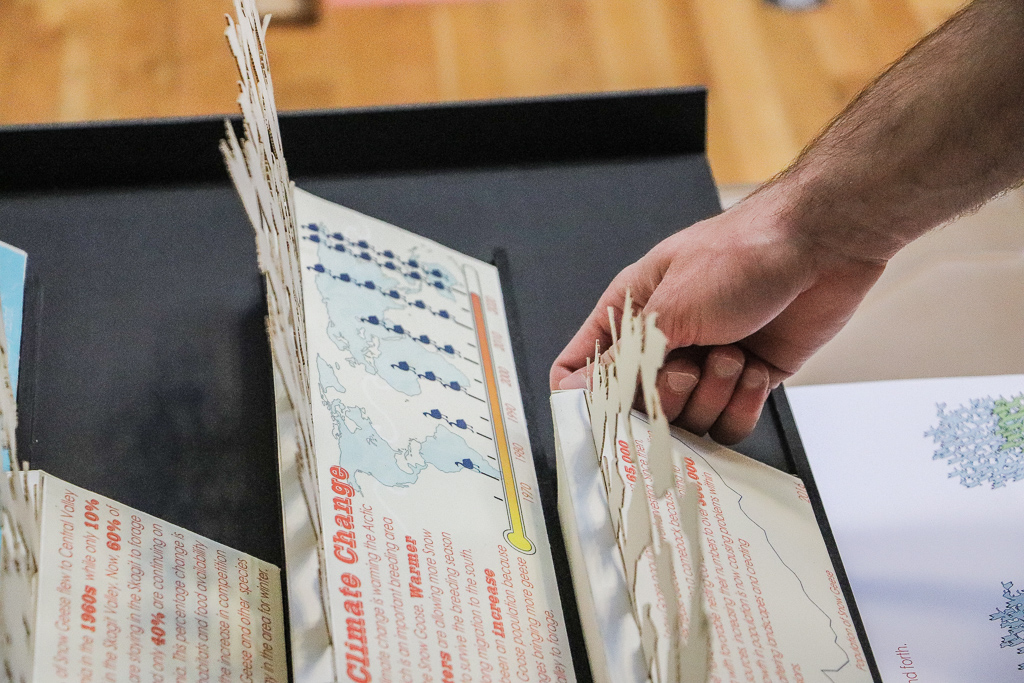
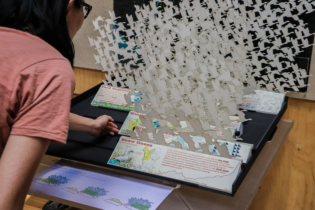
Snow geese (Chen caerulescens) are one of the most abundant species of waterfowl in North America, and, in winter, can be seen in giant white masses carpeting the Skagit Valley. Their seasonal population has increased dramatically in the region in recent decades. Scientists attribute this change to factors relating to changing climate patterns and available resources shifting migration patterns. The increasing presence of these birds in the valley is not without consequence resulting in impacts to agricultural lands, estuarine habitats, and the population itself. This project represents the change in population and the repercussions and impact on the landscape that result. These are represented through the movable flocks that reveal an interconnected series of impacts creating a chain of events.
materials: butter board, plywood, mylar, foam core, wood base
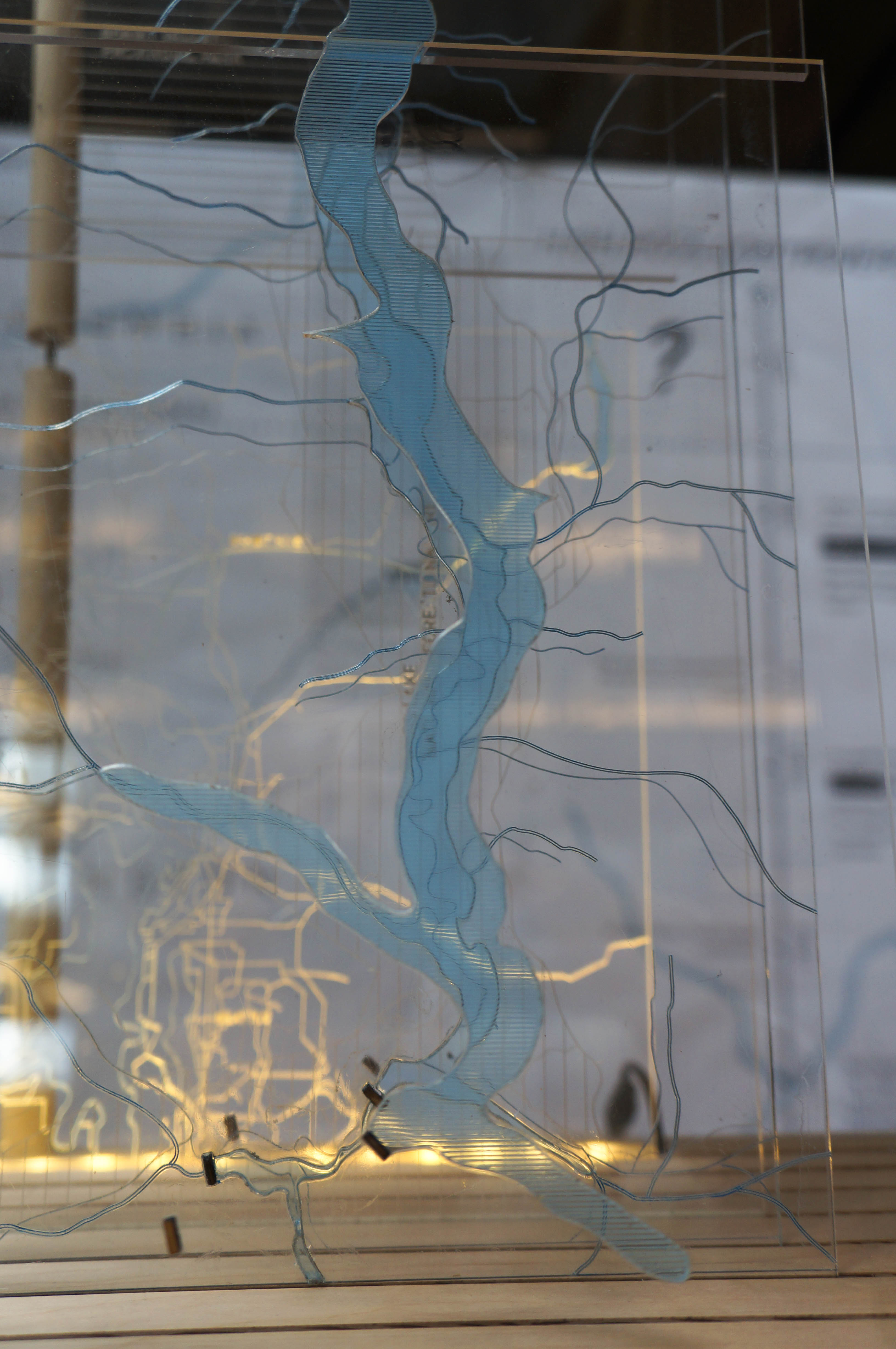
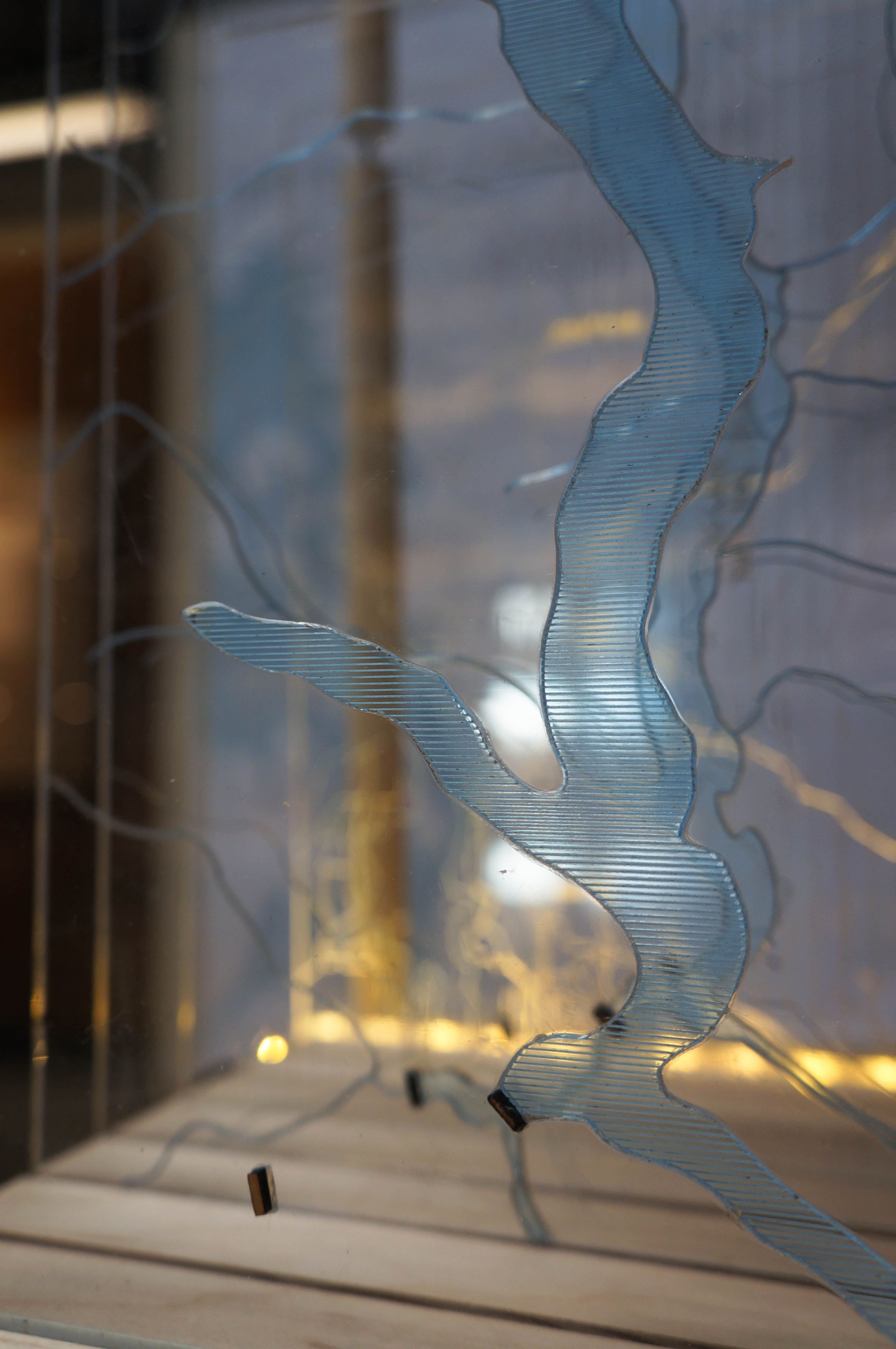
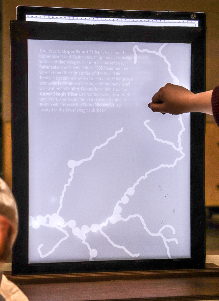
whose 122.5 feet?
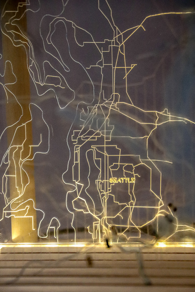
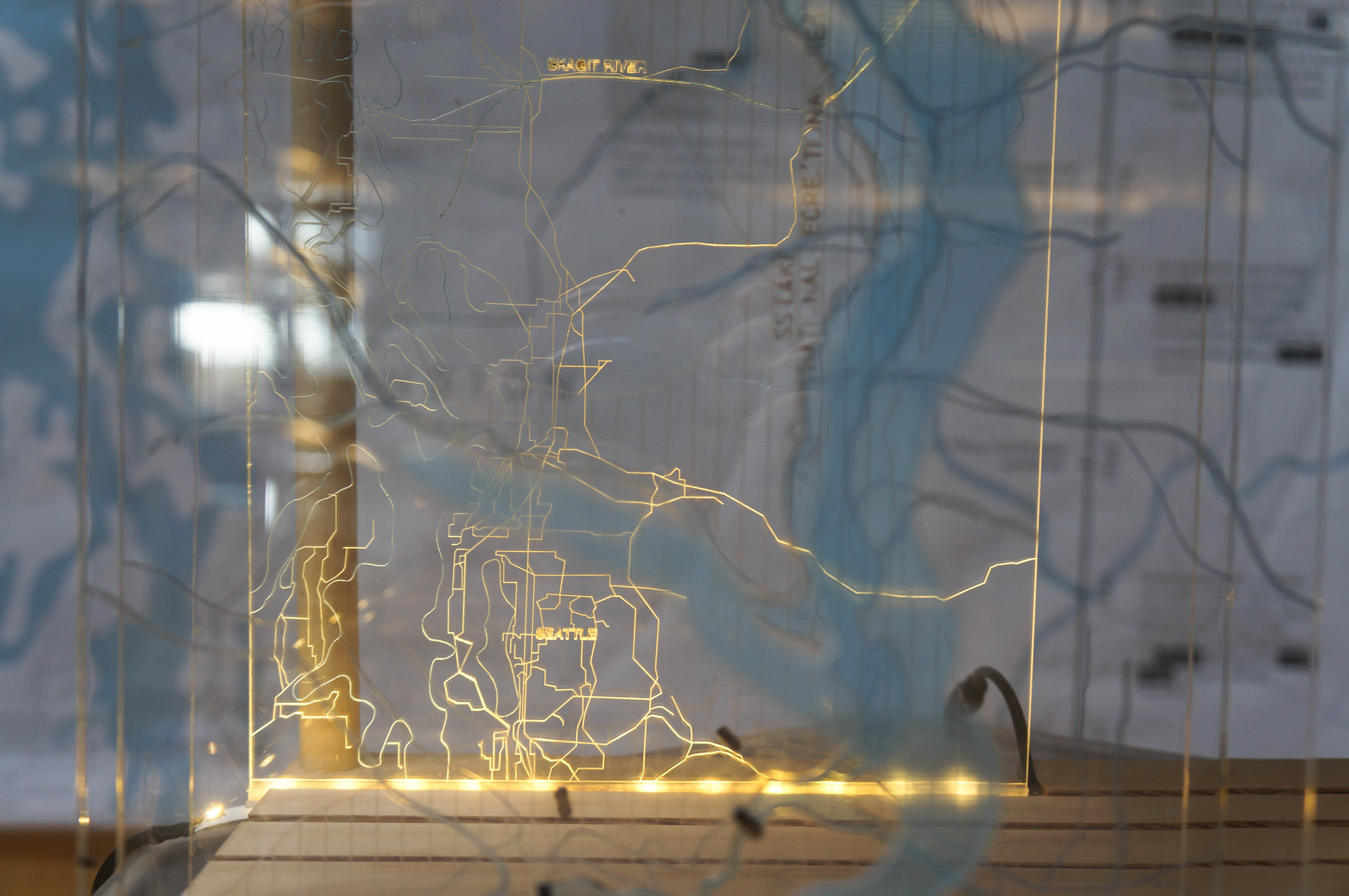
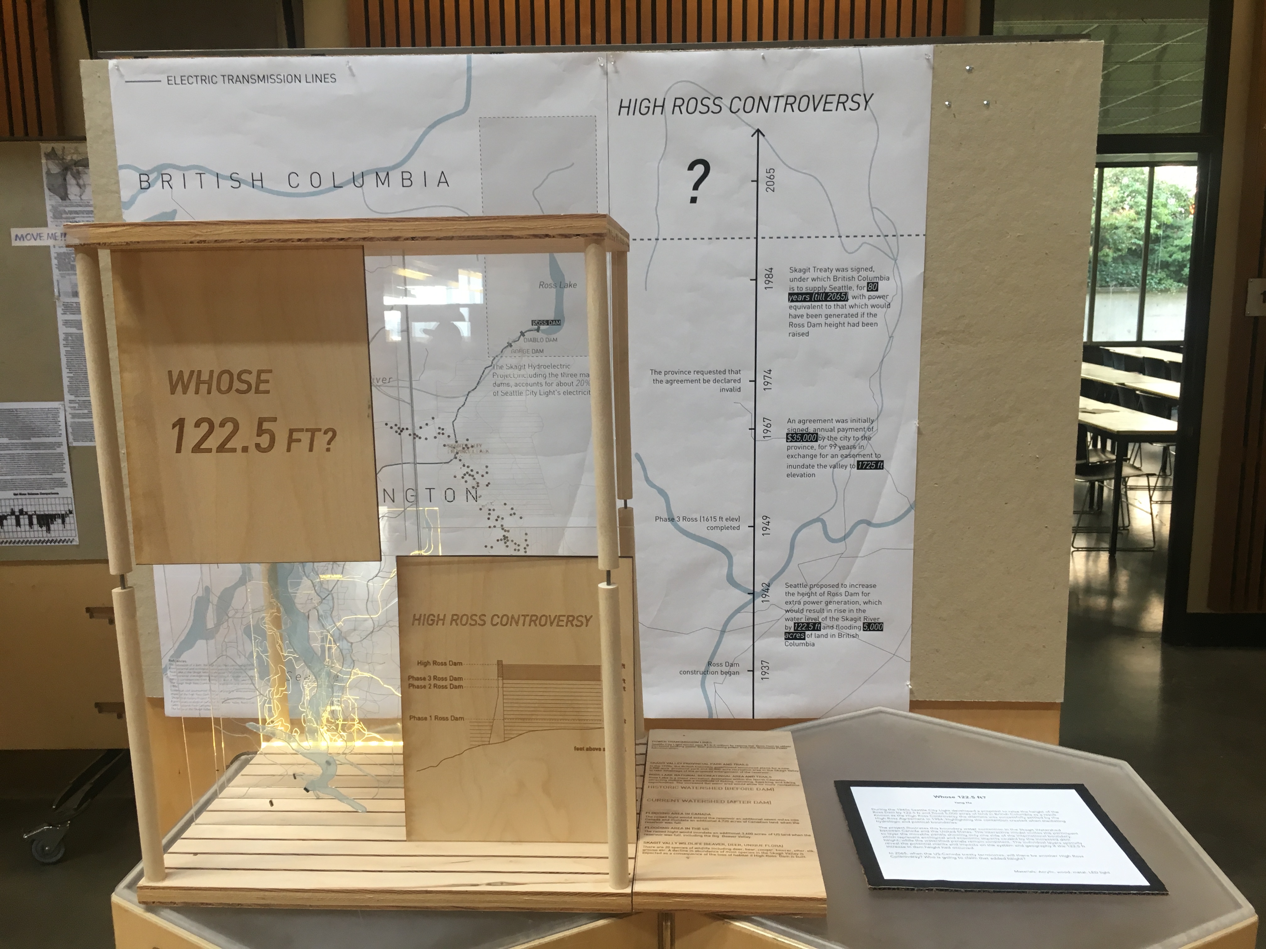
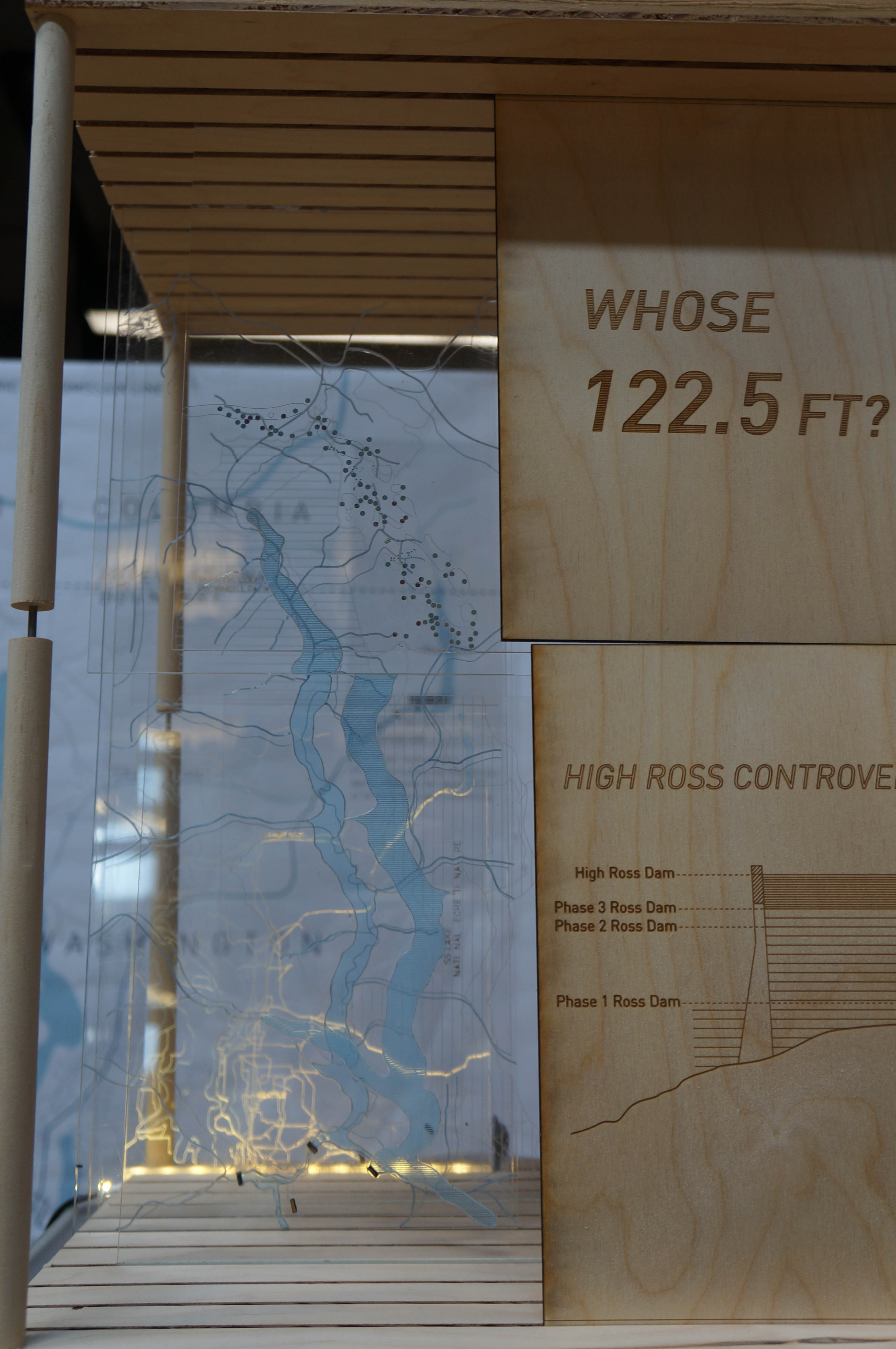
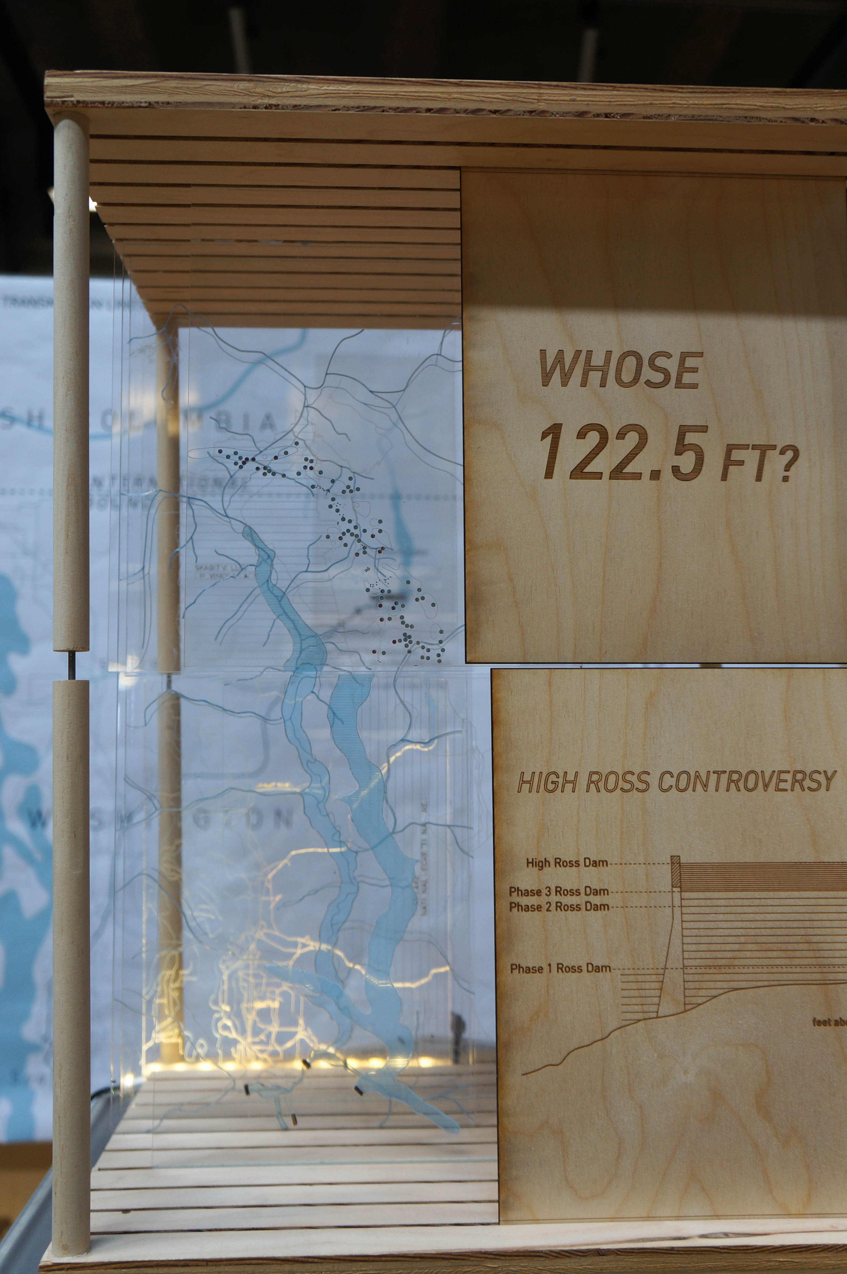

The project is based on the High Ross Controversy, in which Seattle City Light proposed in 1940s to raise the height of the Ross Dam by 122.5 ft and flood 5,000 acres of land in British Columbia as a result. Though the dilemma was successfully settled by the High Ross Agreement in 1984, the argument of political border versus hydrological boundary is noteworthy. When such a decision was made and would result in large scale human interventions in the environment, considerations are mostly from pollical and economic perspectives rather than view the watershed as a whole system.
The project illustrates this boundary water issues in the Skagit between Canada and the United States. The interactive model invites people to piece together and layer movable panels showing only one side of the international boundary, which represent ecological and economic impacts caused by the increased dam height, while the watershed panels remain consistent. The layers show where merits and defects go due to the 122.5 ft increase in dam height.
In 2065, when the US-Canada treaty terminates, will there be another High Ross Controversy? Who is going to claim that added height?
materials: acrylic, wood, metal, LED light
phantom threads
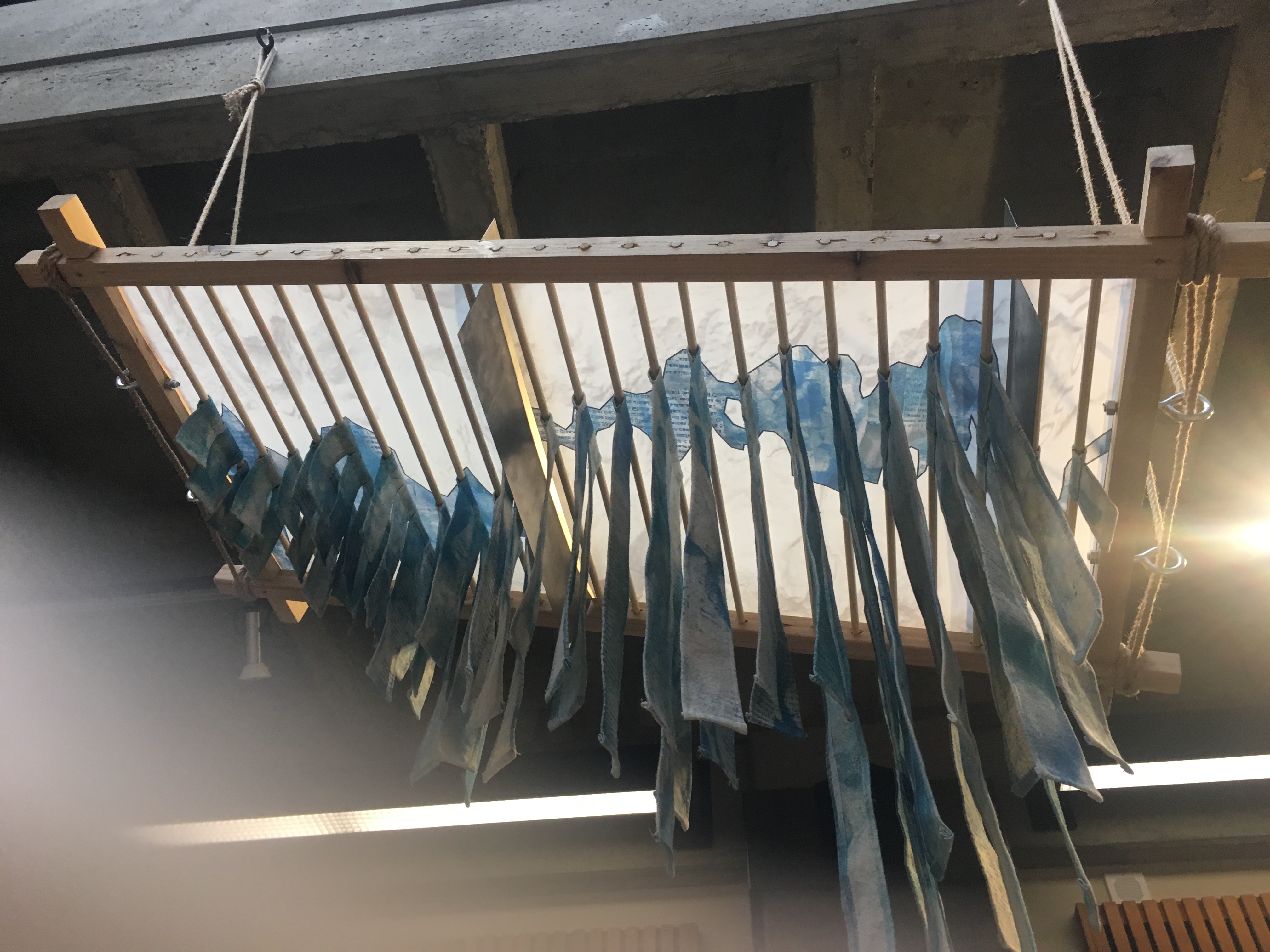
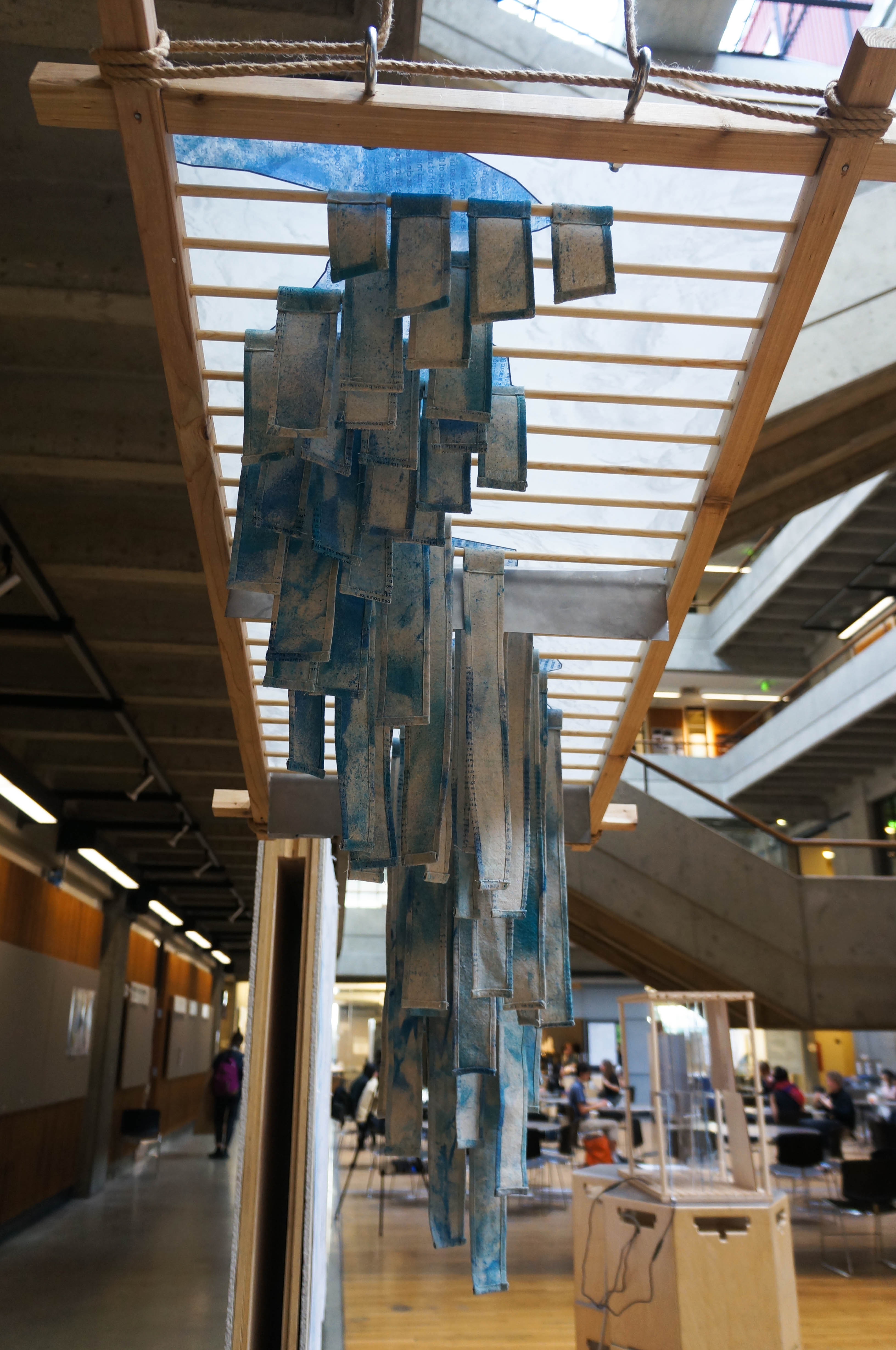
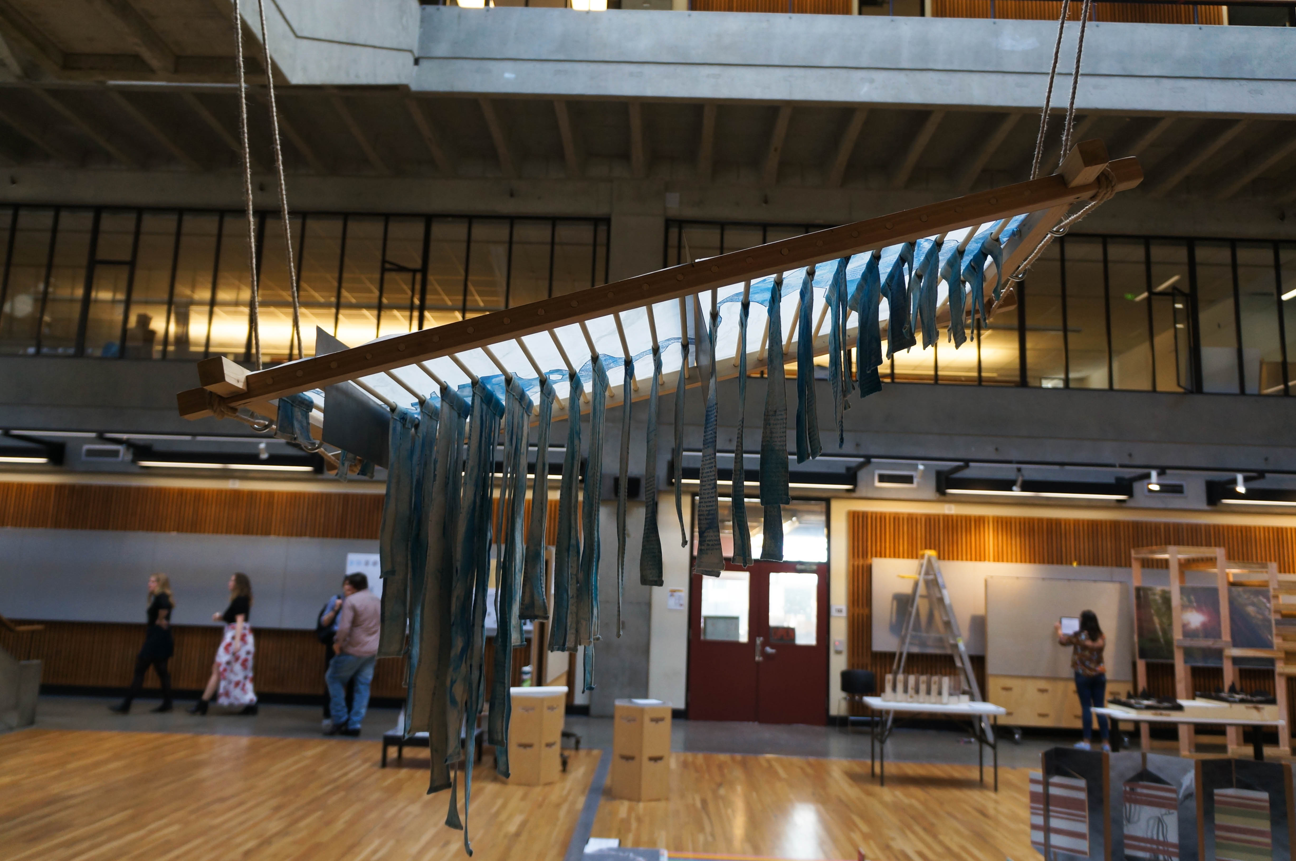
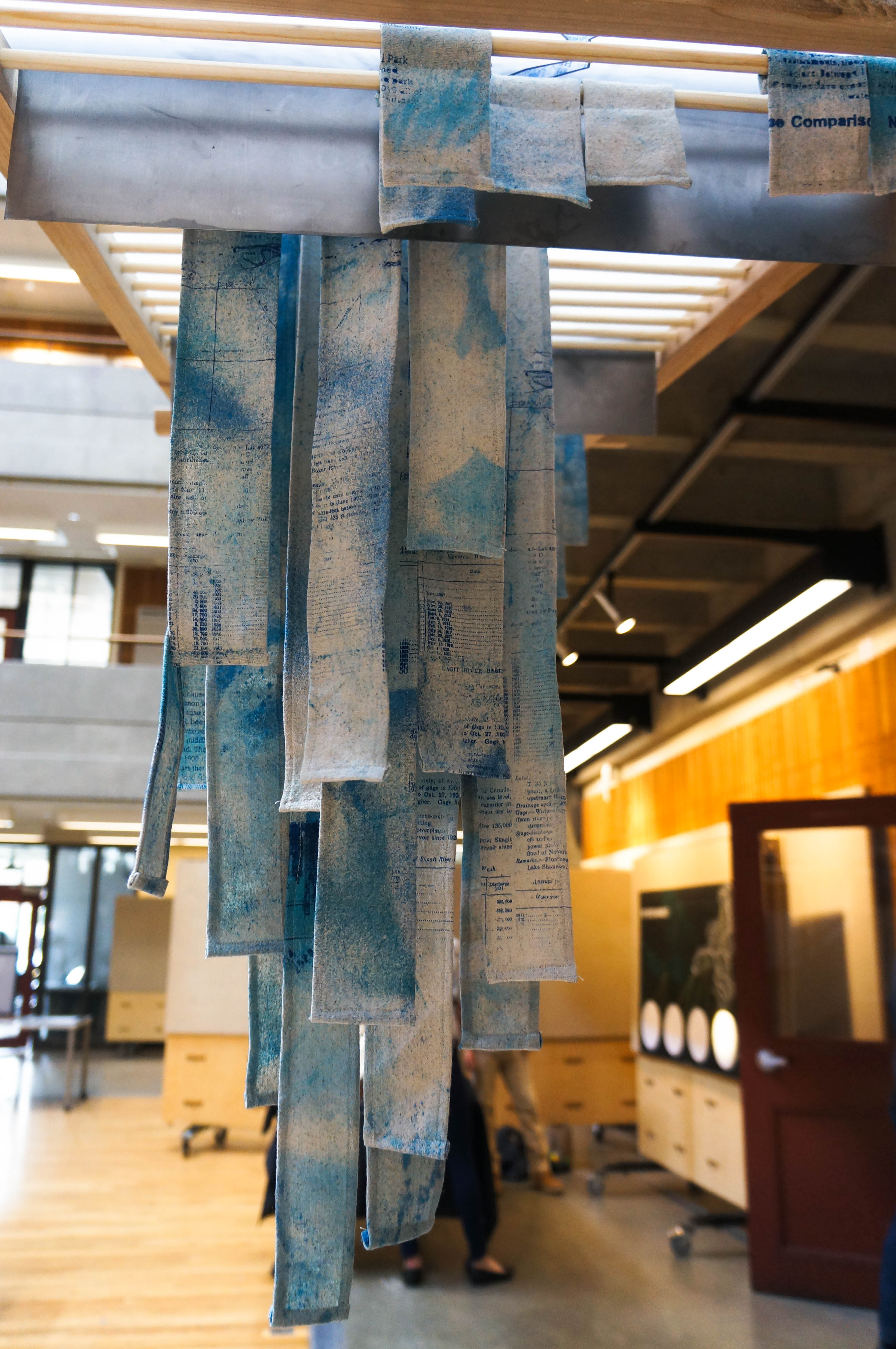
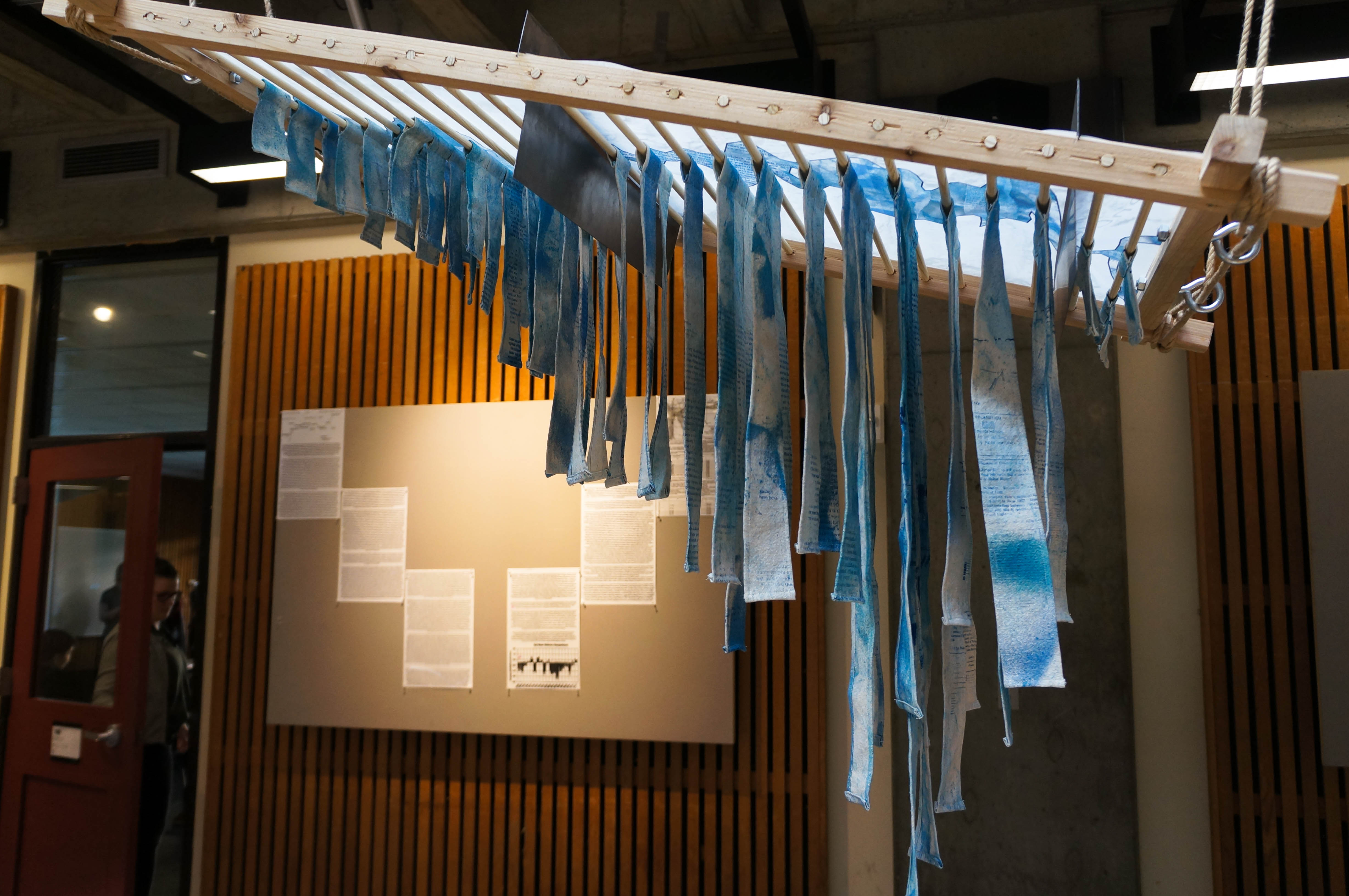
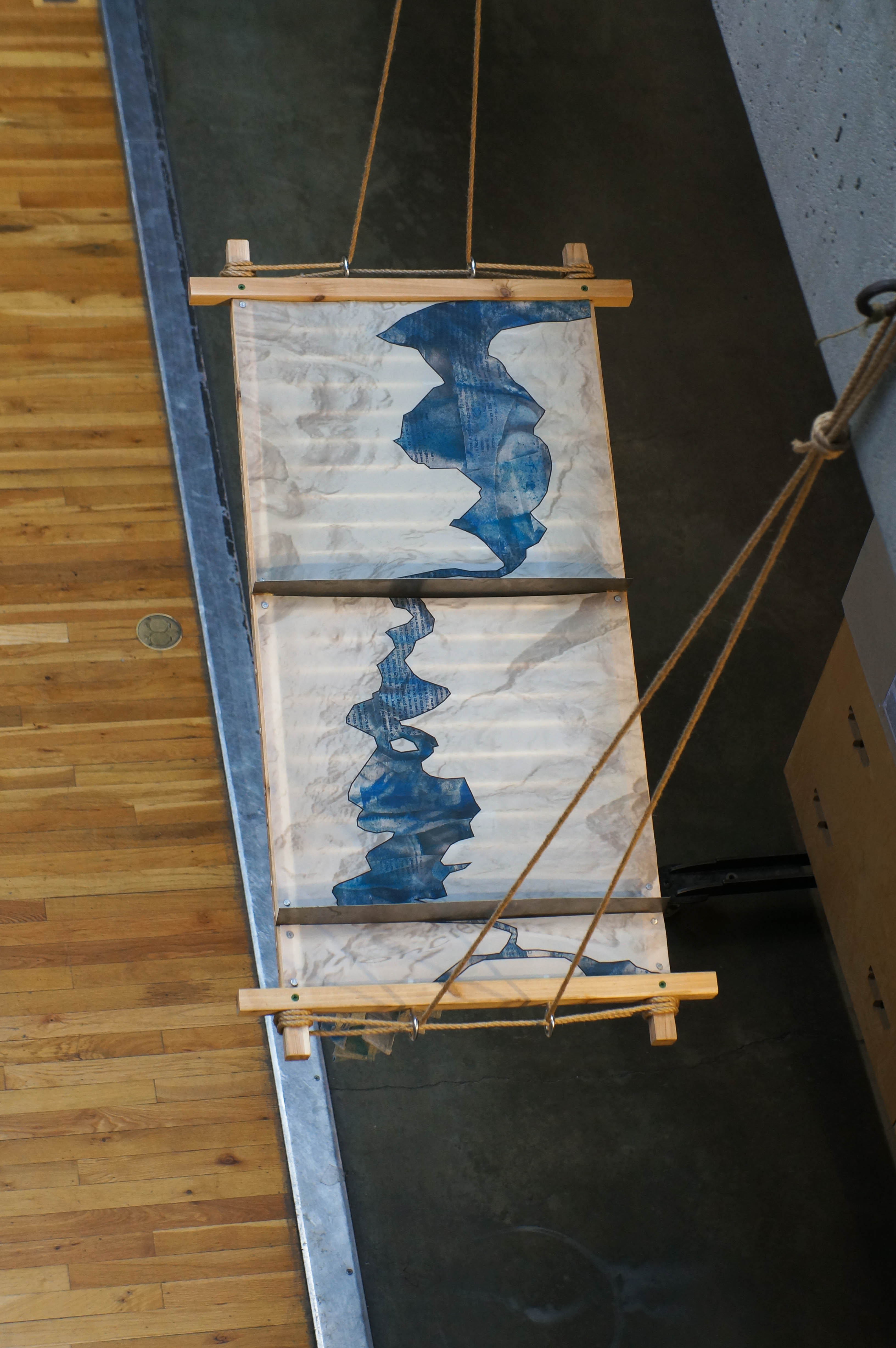
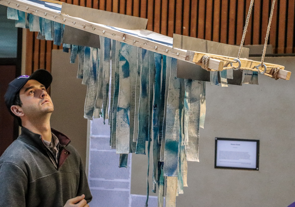
A material investigation into the interwoven histories of cultural, hydrologic, and glacial erasure within the Skagit Watershed. An amalgamation of these stories were uncovered and collected, then screen printed upon textiles that were dyed, sliced, and stitched before being arranged as a representation of the Baker River. Through this transference and treatment much of the content to these histories is lost creating an arena where these stories vie for the attention of the viewer. What hidden threads are you able to extract?
materials: cedar, poplar dowels, steel sheeting, cotton textile, cyan ink, shibori dye, jute rope, eye bolts, screws
mining for solutions
entry abstract:
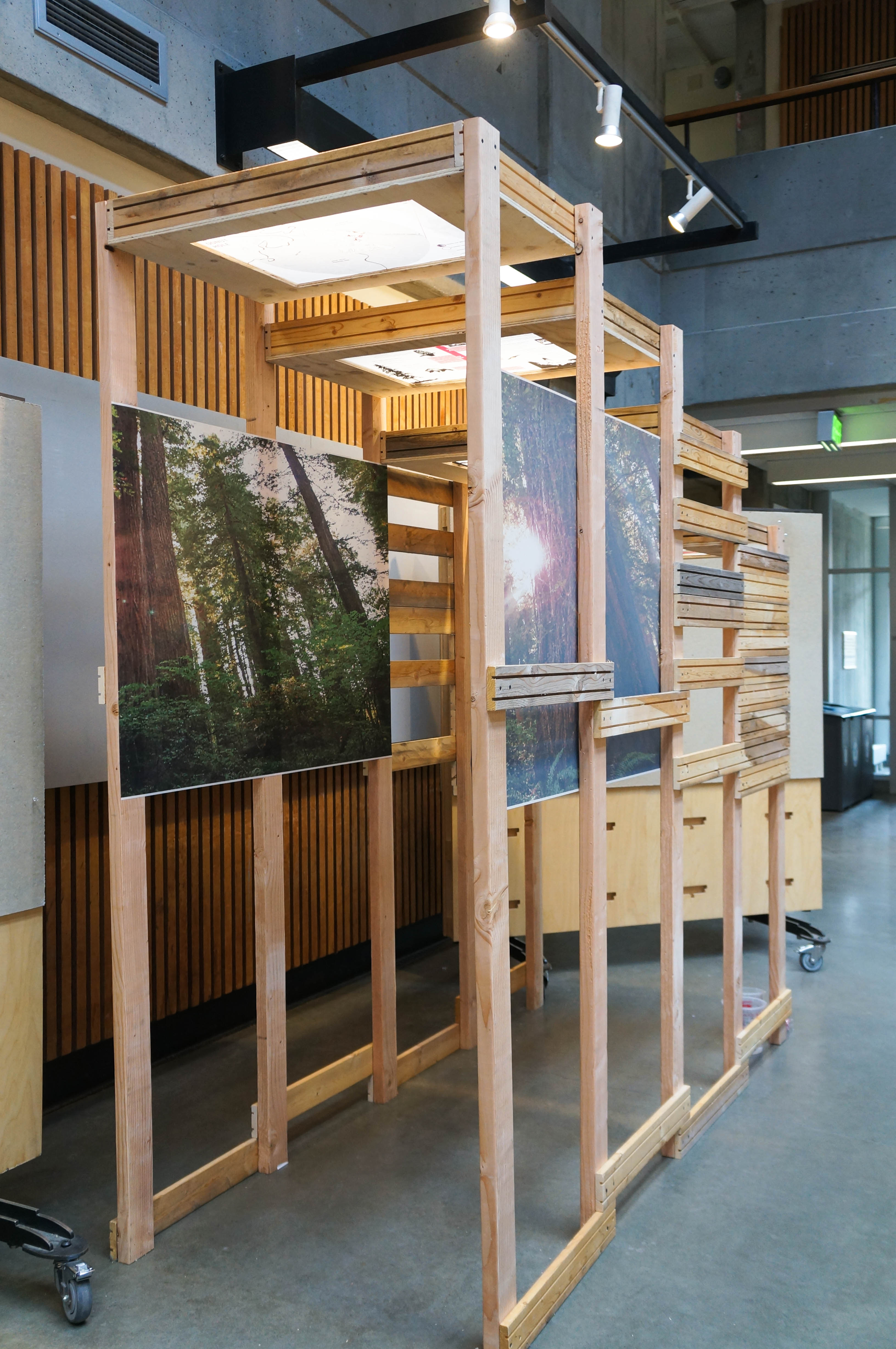
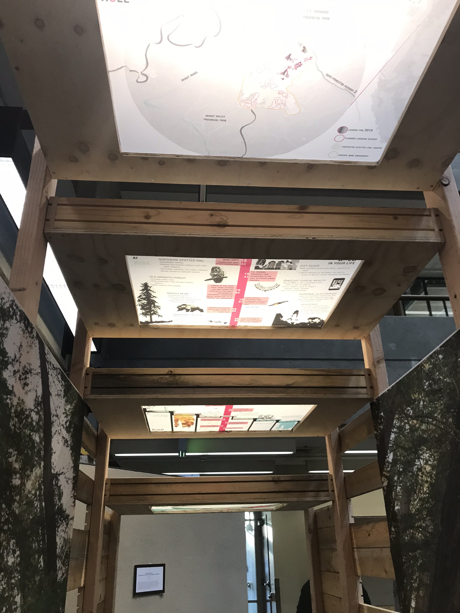
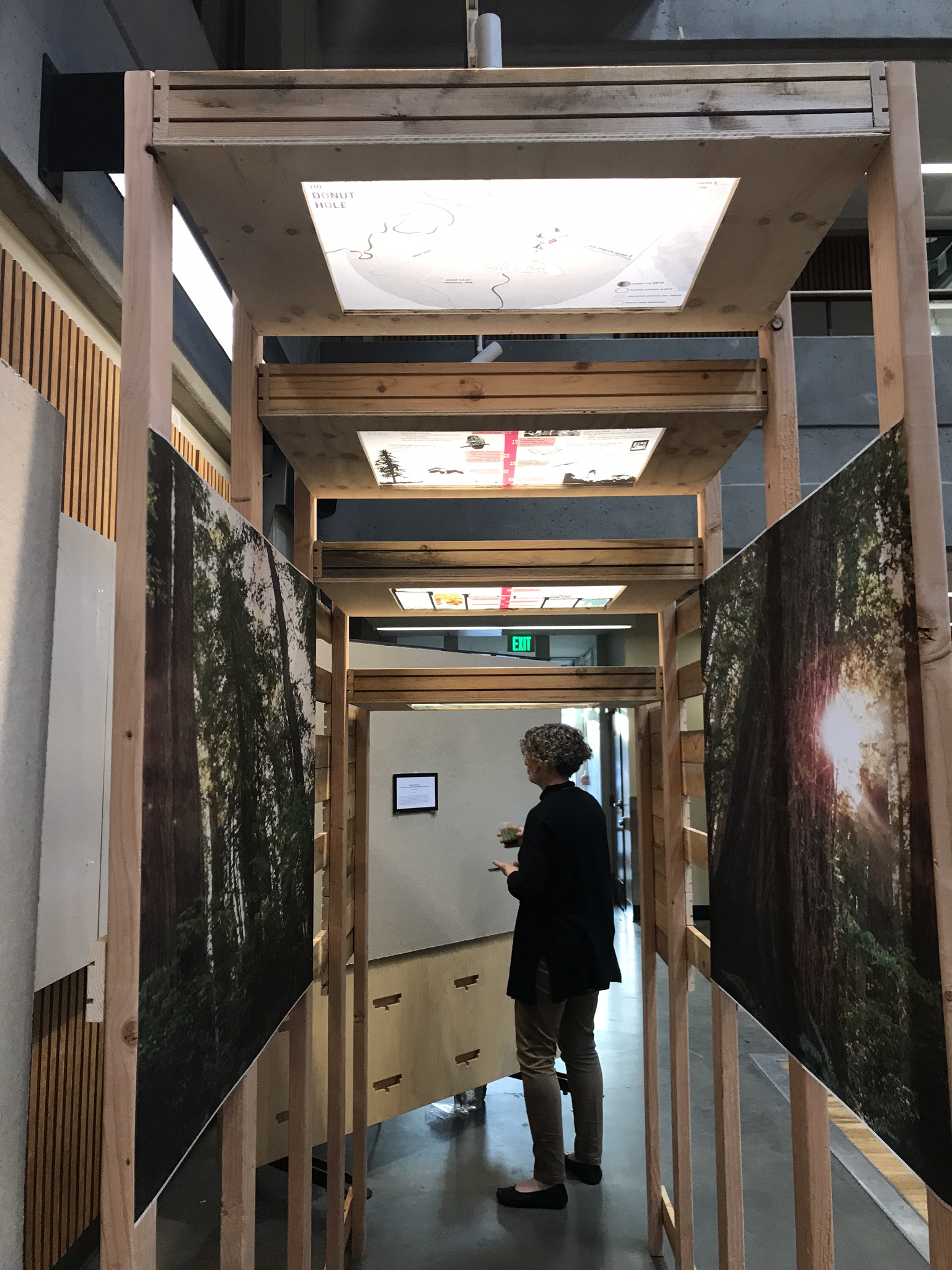
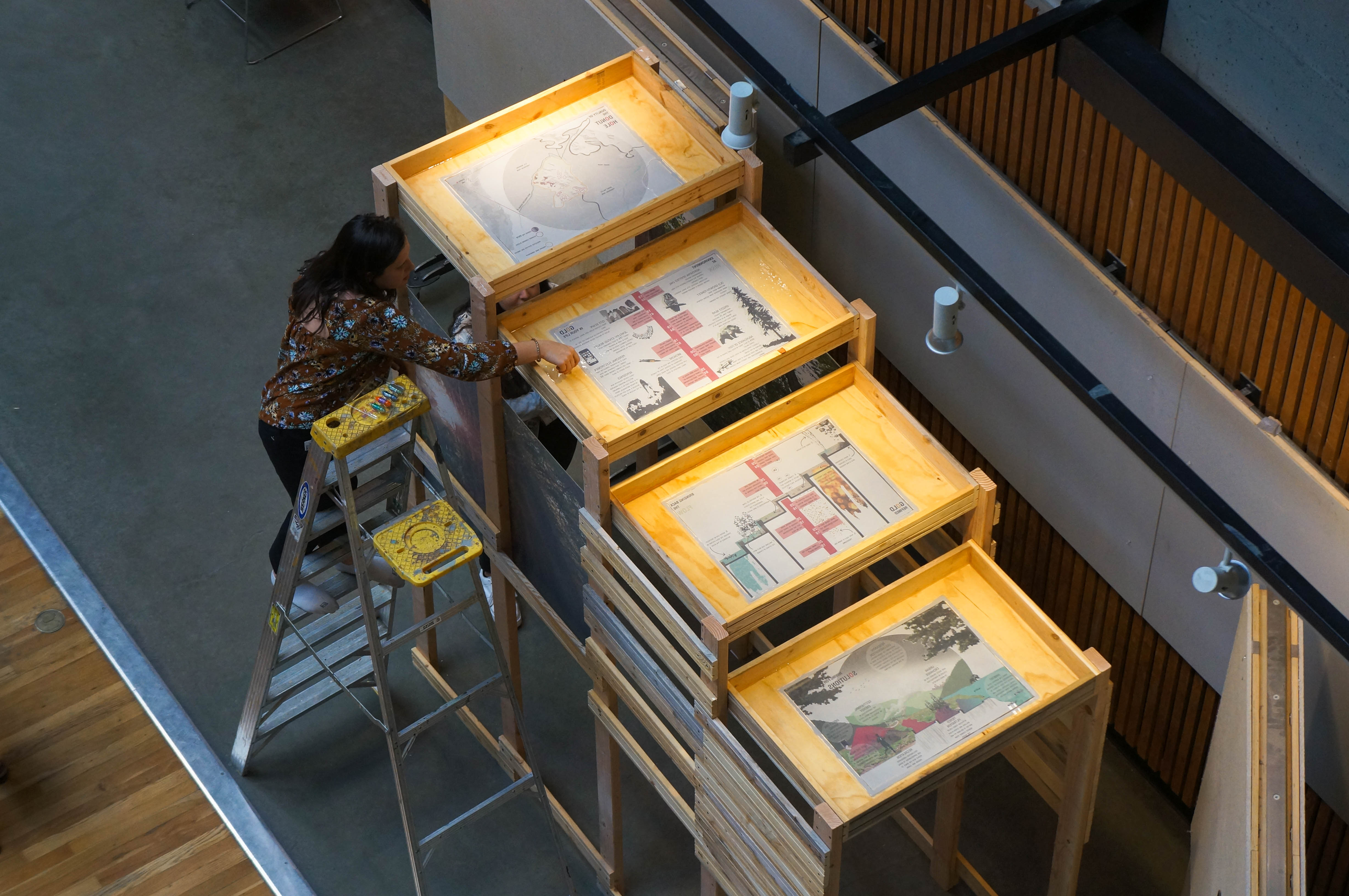
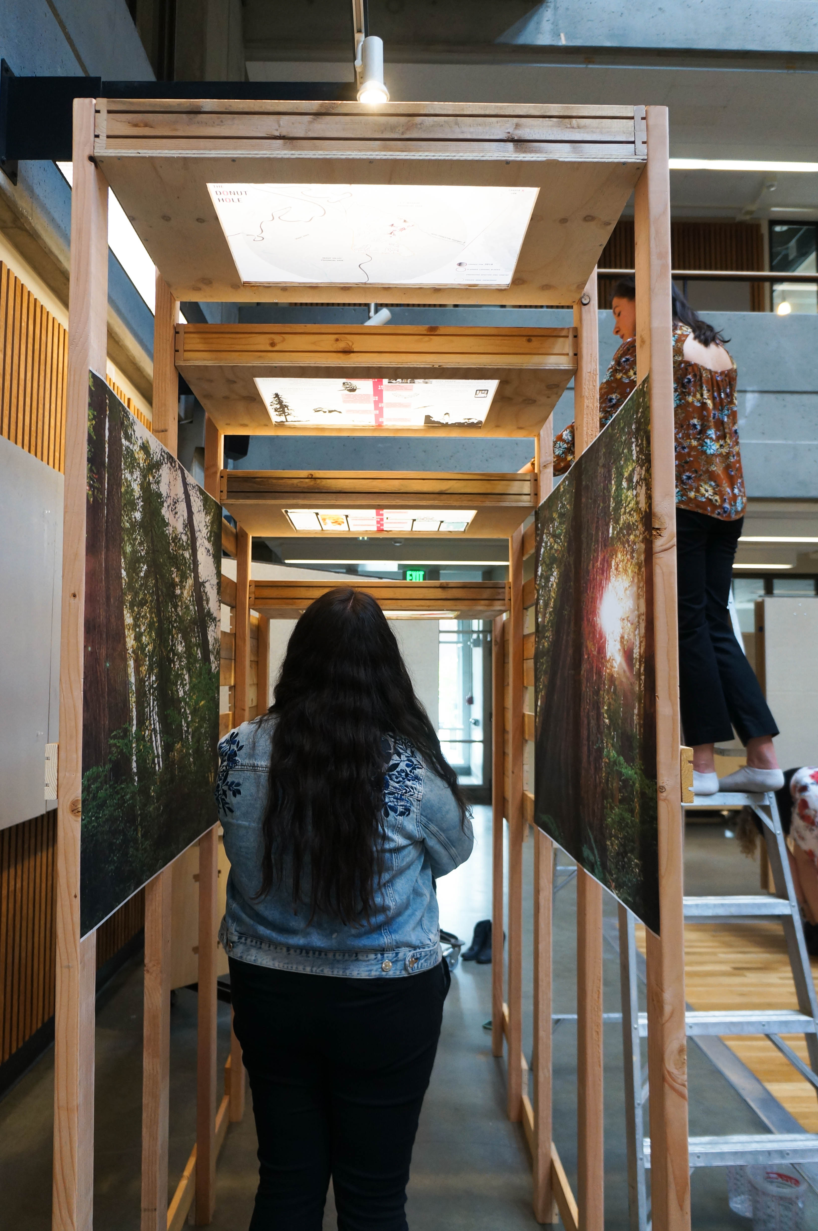
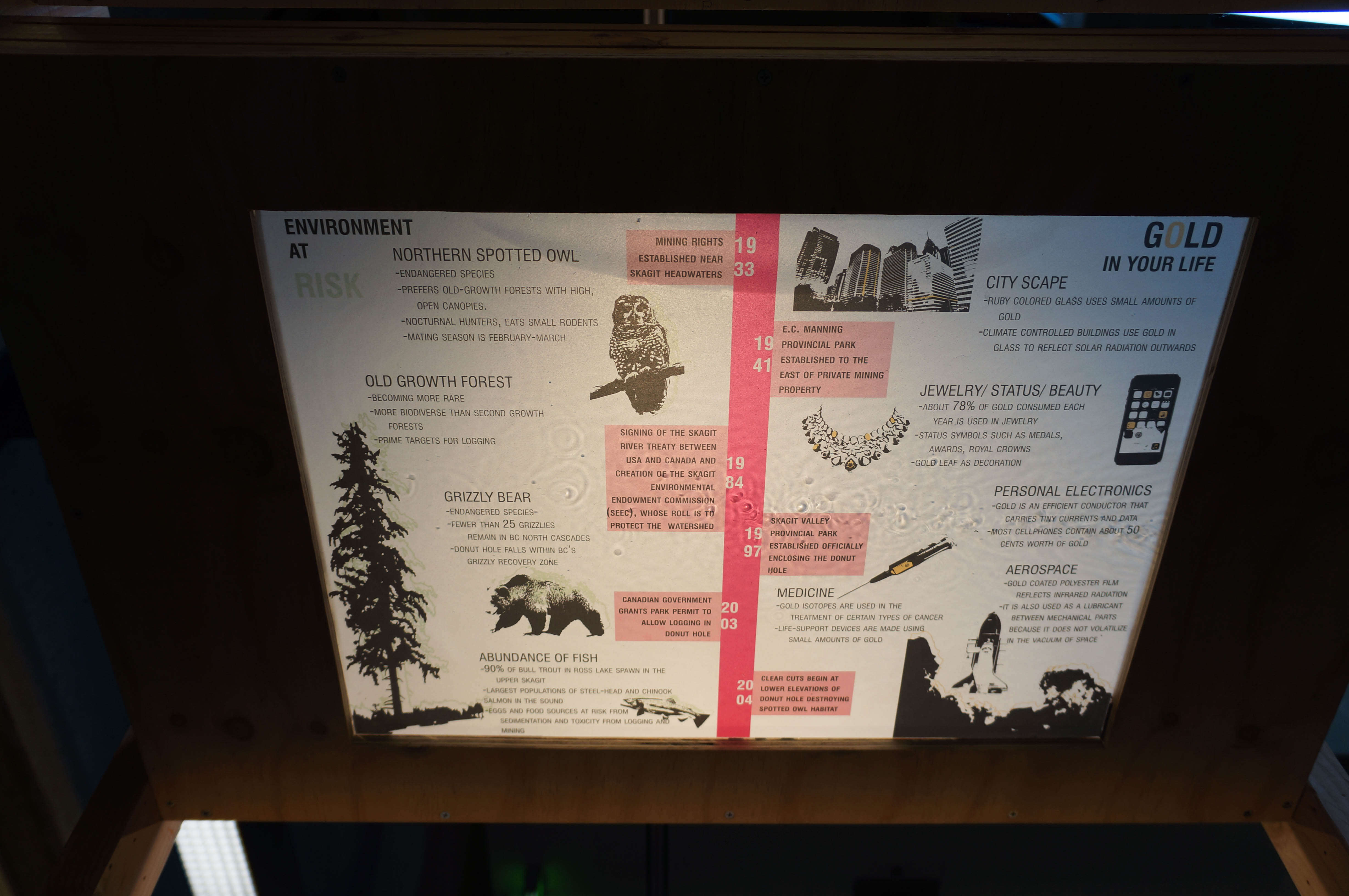
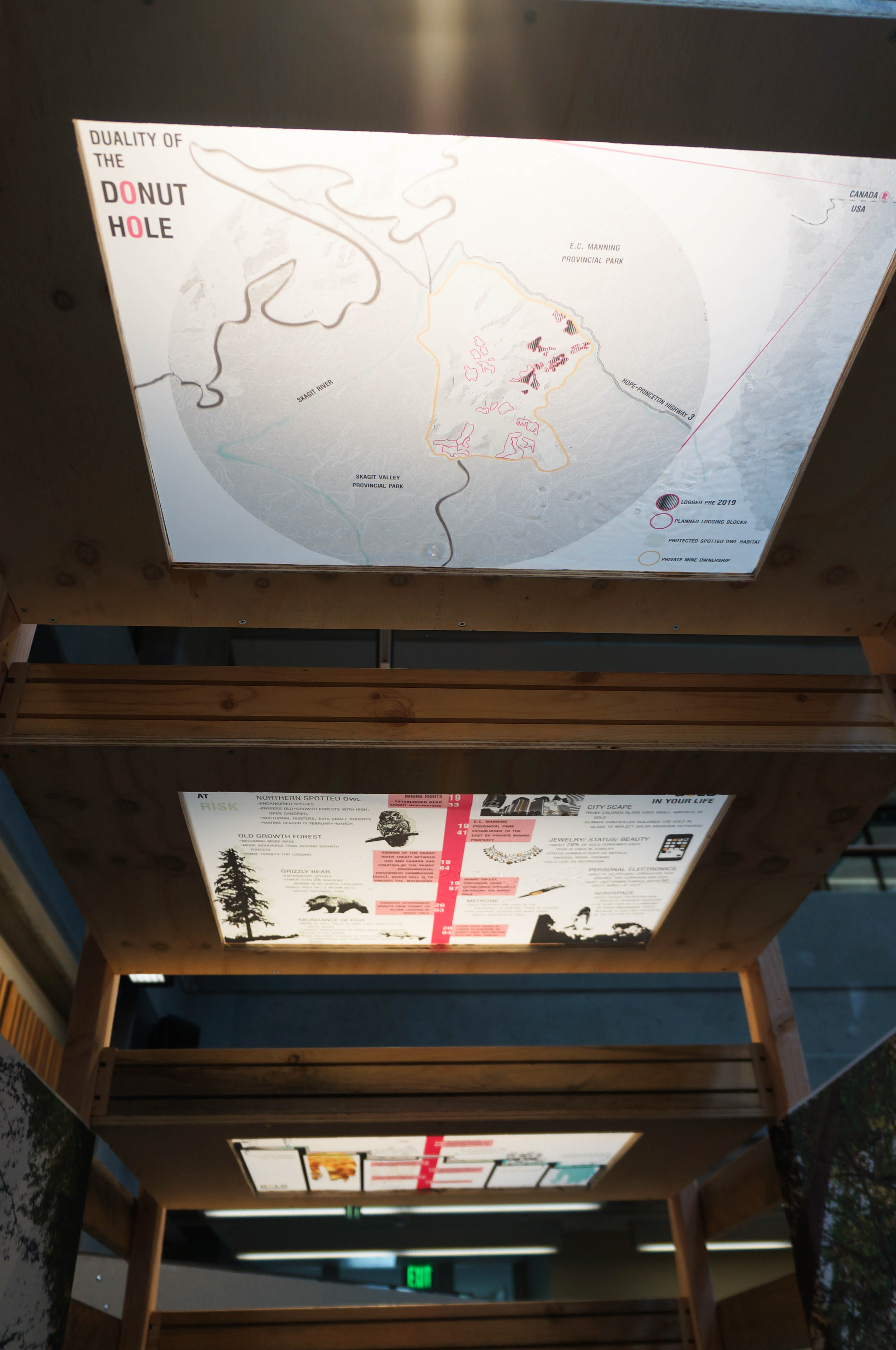
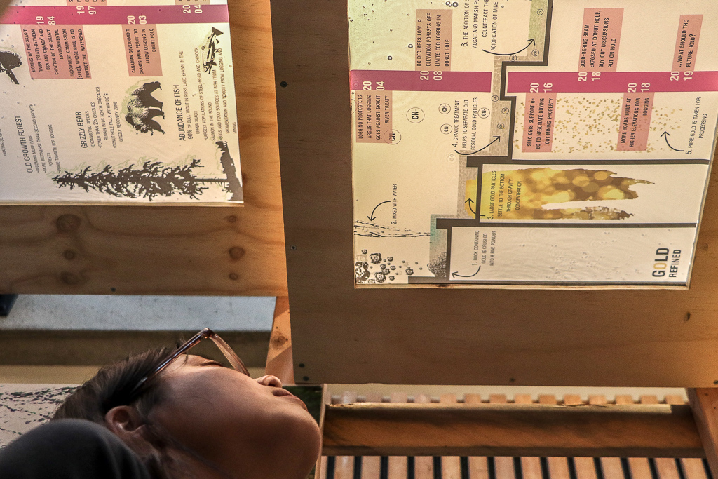
I began this project in protests. I researched a variety of events throughout the Skagit Watershed that incurred protest, which is how I uncovered the conflict surrounding the Donut Hole. The Donut Hole is located in British Columbia, just north of Ross Lake, in the headwaters of the Skagit River. This piece of private land is surrounded on all sides by protected provincial parks and is the site of a clash between environmentalists and resource extraction companies. Currently there is logging taking place on the land, but there is also potential for a gold mine to be established there. Between environmentalists and the gold mine owners, each of them is pushing their own agendas without much concern for the other. Through this project I am exploring a scenario in which both could exist in the same landscape.
exit abstract:
This is one vision from one person in an academic context. This piece serves to bring the viewer into my own experience with this space and my own struggle to find a landing place for my ideas. I could have easily argued that there is no need for gold mines anymore, because there is plenty of processed gold already in existence and what we need are methods of recycling it. This installation is not a conclusion, it is a means of changing perspective physically and mentally and to open the door to creative solutions necessary for today’s wicked problems.
materials: plywood, recycles 1X4, plexiglass, silicon waterproofing, 2×4 lumber, screws, mylar, water
two places, one place
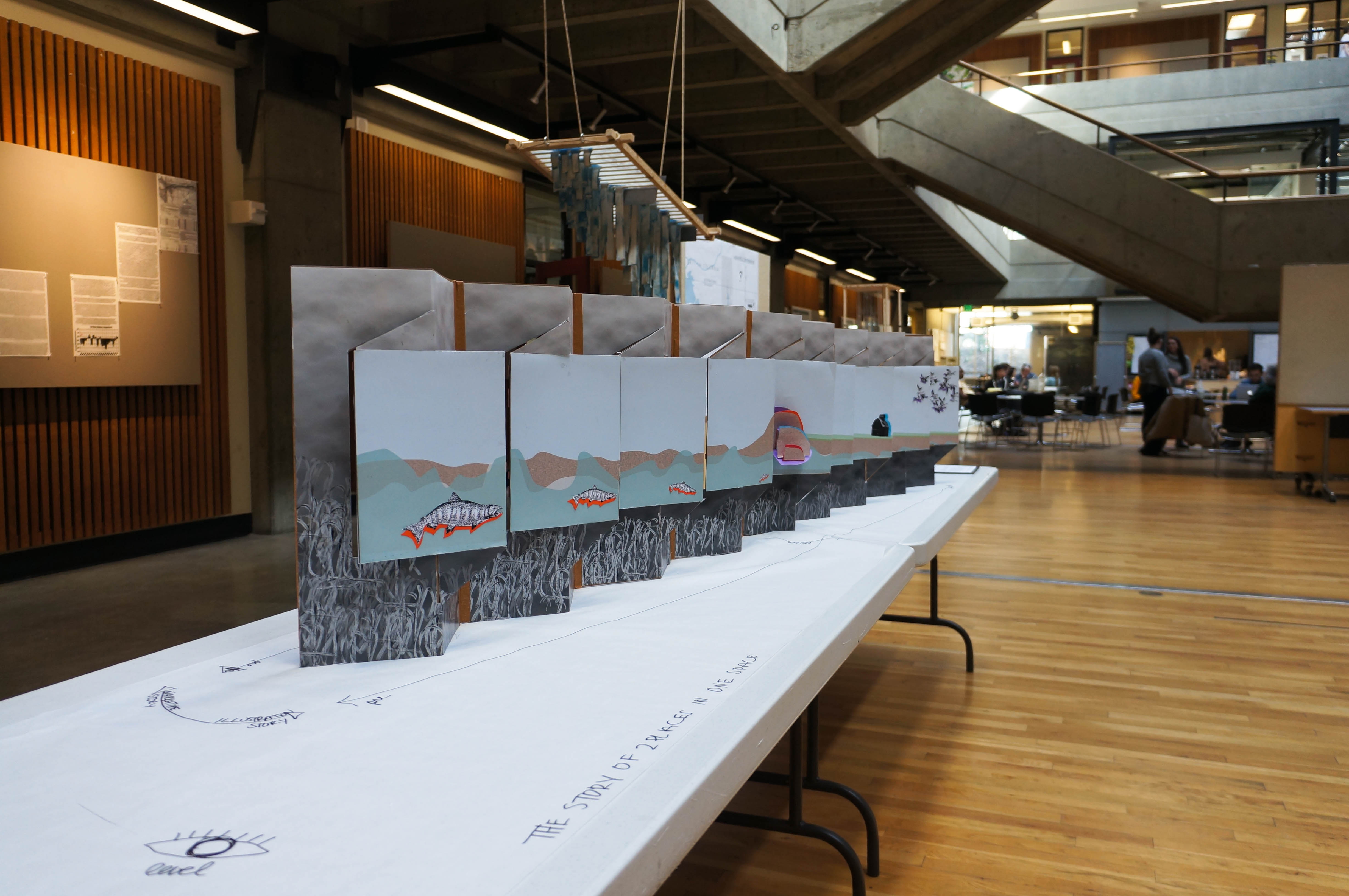
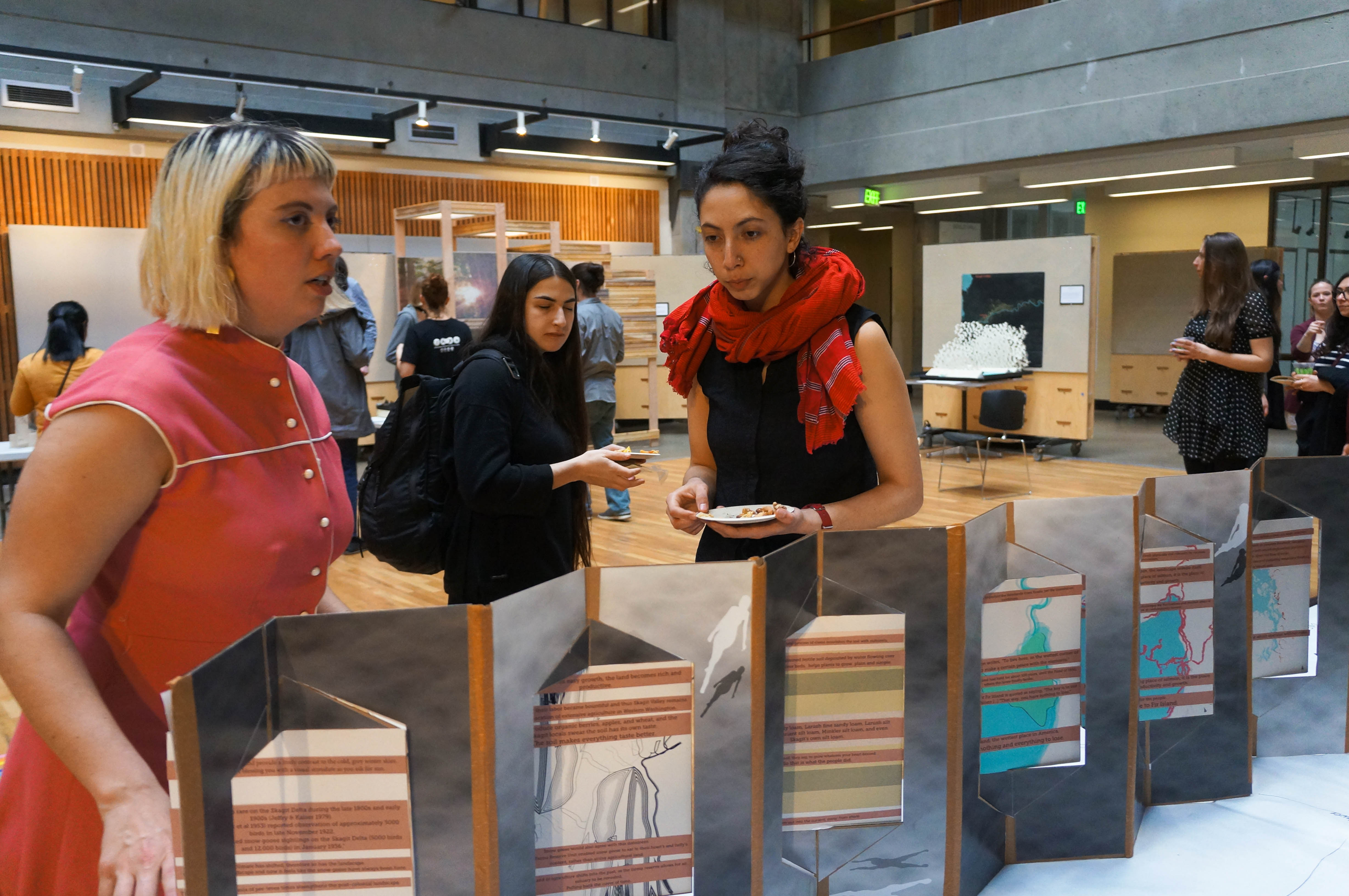
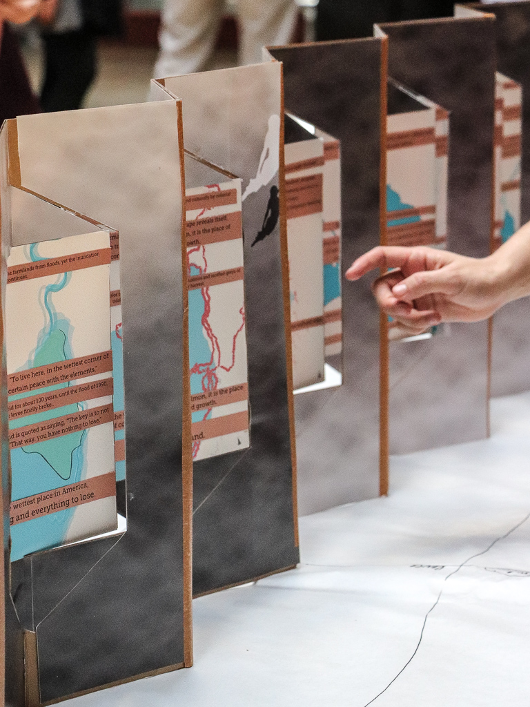
Zooming in and out of one place called Fir Island. The other place is unnamed, but exist as the mouth of the Skagit River. Both live in the same space. Human intervention has created a before and after, Fir Island being the after. The levee system creates a pin holder in time, which is illuminated in the present landscape. This pieces cuts linear time and plays with it. The user is allowed to interact with varying storylines and the collective story in its entirety. As the user visit the images, you are revealed the vertical occupancy of the levee, as one reads the word the ecologies are explicit through time. Shifting ecologies at Fir Island, the wettest place in the states, create the every growing question; what next?
materials:e-flute, gloss print, dry adhesive, construction paper, magnets and book binding tape.
nuclear reactions
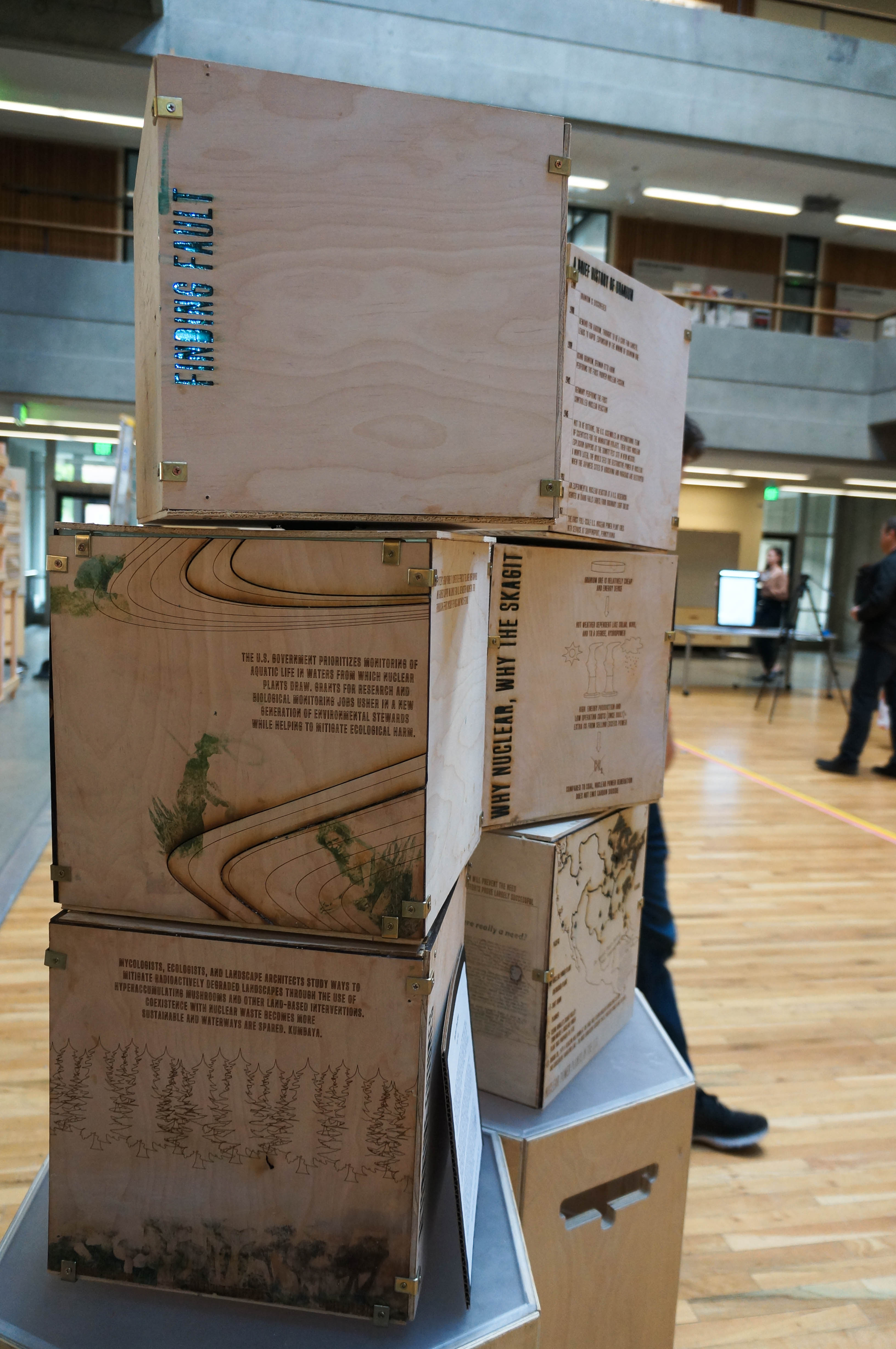
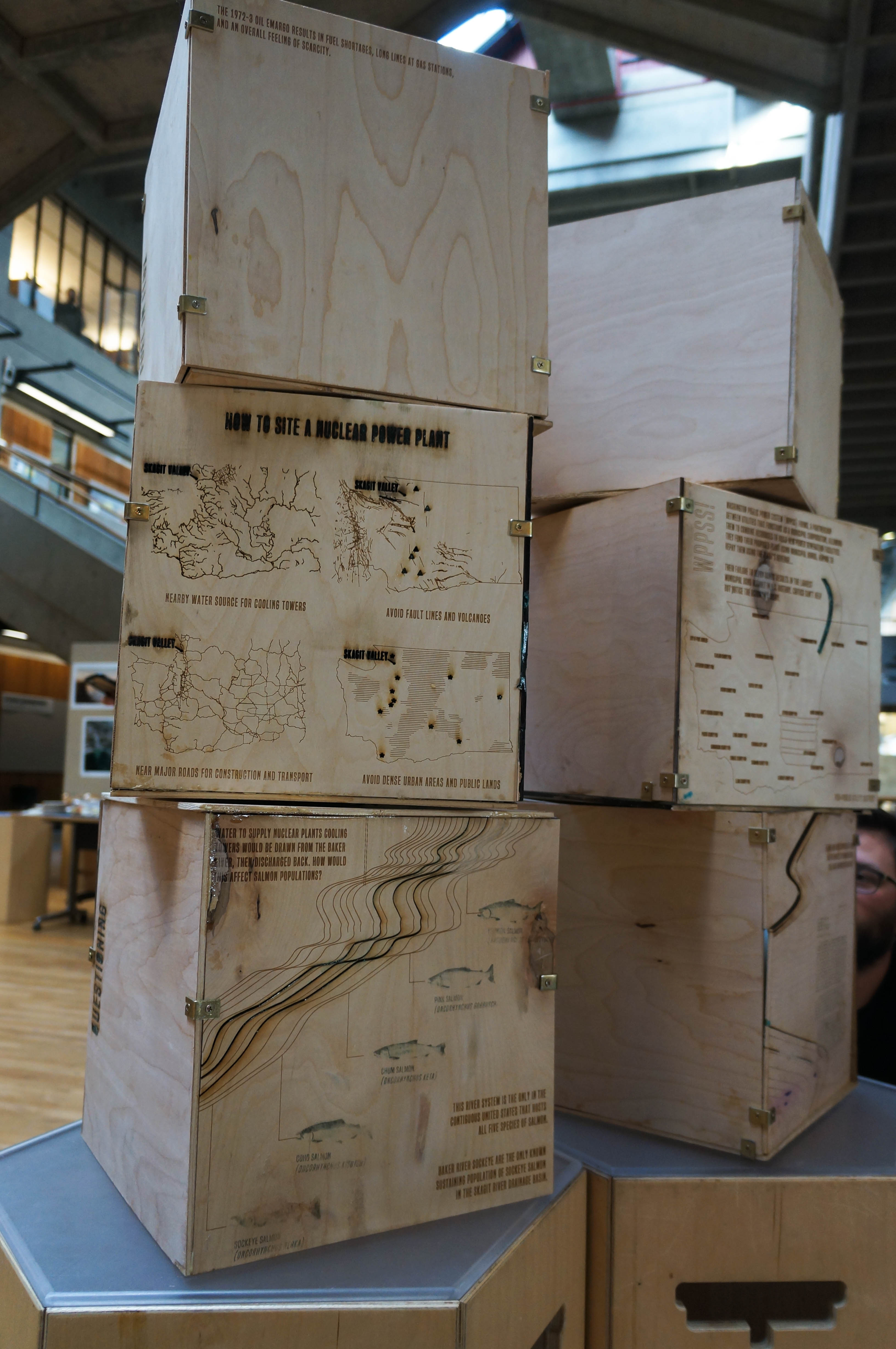
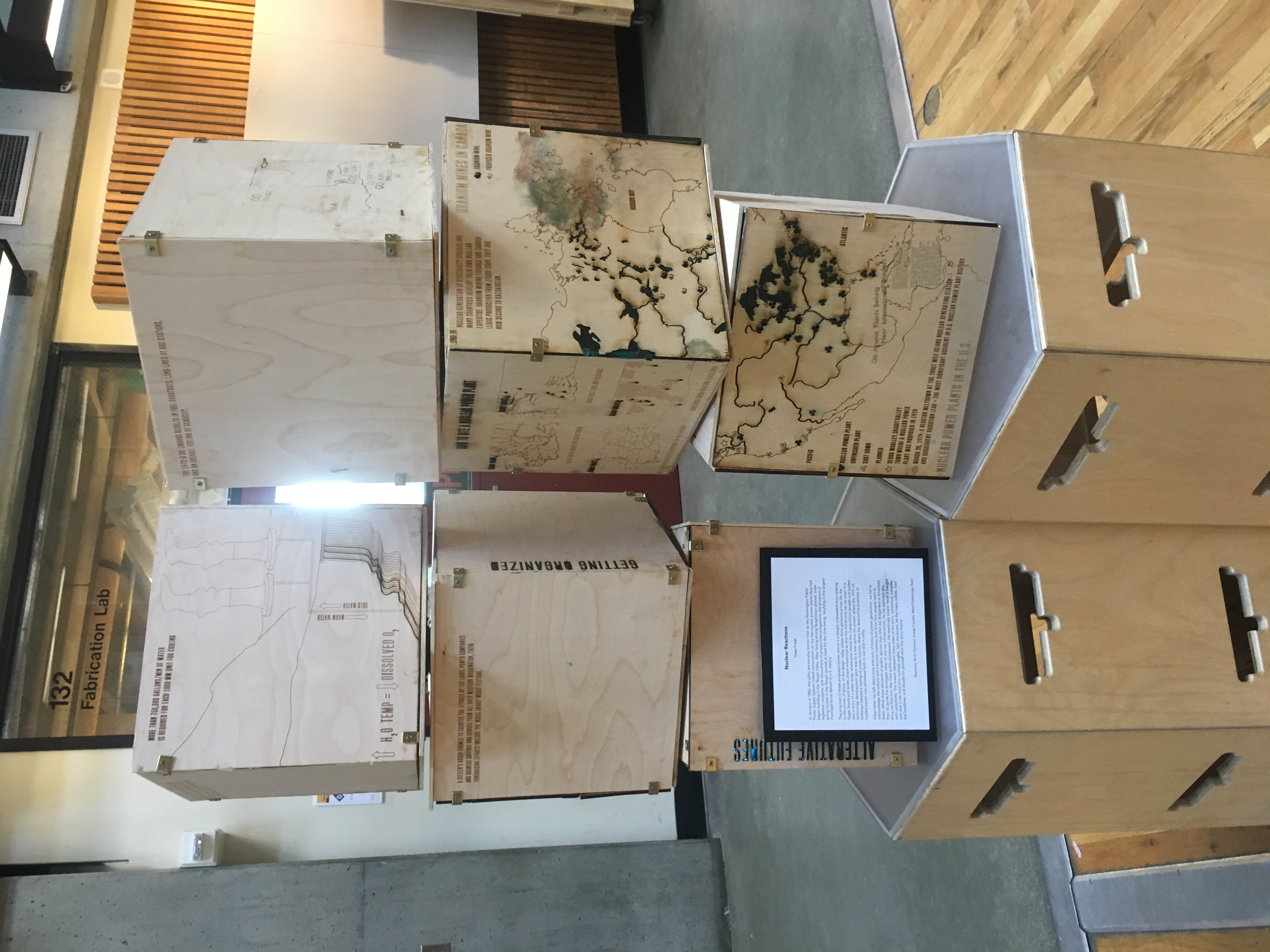
In January of 1982, the utility partnership known then as the Washington Public Power Supply System halted construction on the two nuclear power plants they had begun building in the Skagit Valley. After facing strong Skagitonian protest, state legislator concerns, and accusations of project mismanagement, the prospect of going nuclear in the Skagit ceased, at least for the time being, resulting in the largest municipal bond default in U.S. history.
The proposal of these proposed power plants is a deeply embedded story relating to the power of place, of the Skagit Valley where dams generate power for the Puget Sound and levees shape waterways so that the fertile land can be sown. It is also a story of a wider scale where post World War II population growth and nuclear technology development gave way to a new option for power; where the 1973 oil embargo created a feeling of power scarcity; where the destructive potential of nuclear power was witnessed both in way and in utility.
Often when we talk about pros and cons of forms of power generation, we fail to acknowledge the cultural and historical contexts that drive how people react to them. While these elements of public opinion may often be disregarded or trivialized, they do guide the strategies taken to site our infrastructure. As we approach this story we find that, like most public processes, the seemingly simple result is fraught with complexity. The towers represent these sides of the story; contextual, complex, and able to be read from multiple angles. Spin the boxes, let the maps collide, read the headlines, and decide for yourself what this story means.
materials: birch plywood, image transfer, metal fastenings, resin
lenses of control
Revealing and Obscuring Relationships of the Upper Skagit Headwaters
This project is meant to reflect five perspectives of the story swirling around the control of the Skagit River headwaters. Each perspective is represented by a lens, through which the user might see through, and what that user perceives when they talk about the upper Skagit River. While it is easy to see the project through one lens, the story becomes more complex and harder to read once multiple lenses are layered together, obscuring each other and vying for control of the viewers eye. This is often the case when people hold discussions about wicked problems surrounding control and abundance of water, a scenario that is sure to become more prevalent in the years to come. What are the lenses we look through? What does the competition of lenses obscure about the whole story? What does the layering of lenses reveal in the relationships of these seemingly disparate views? How can we use this information to restructure the way we present discussions about the Skagit River and water rights?
materials: wood, backlit film, ink, woodglue, light
terrain flows
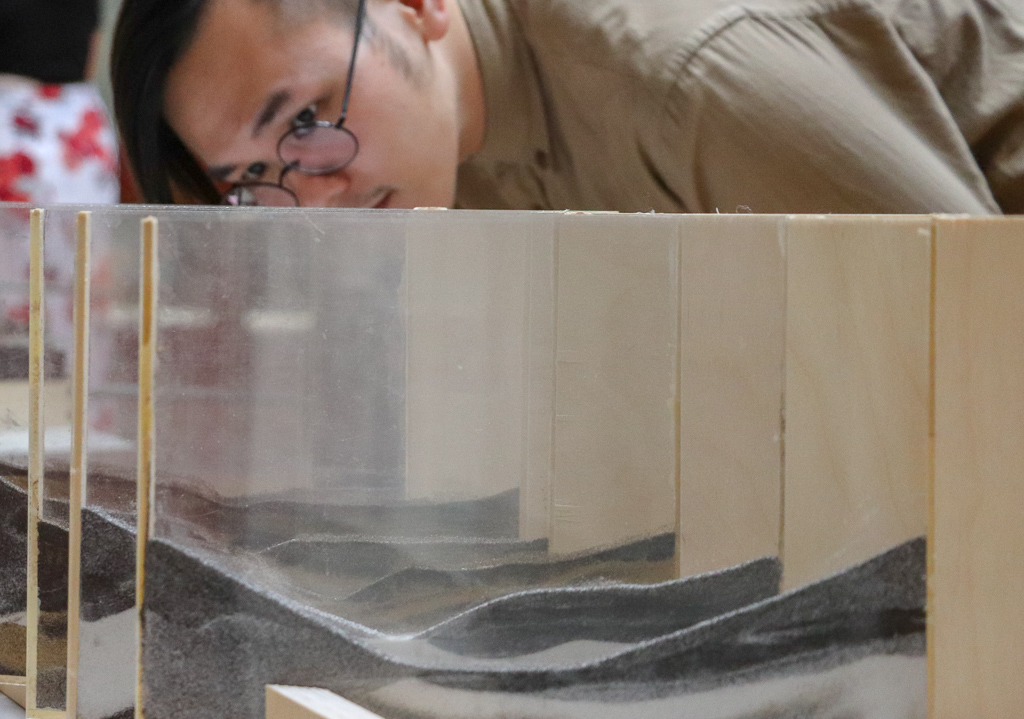
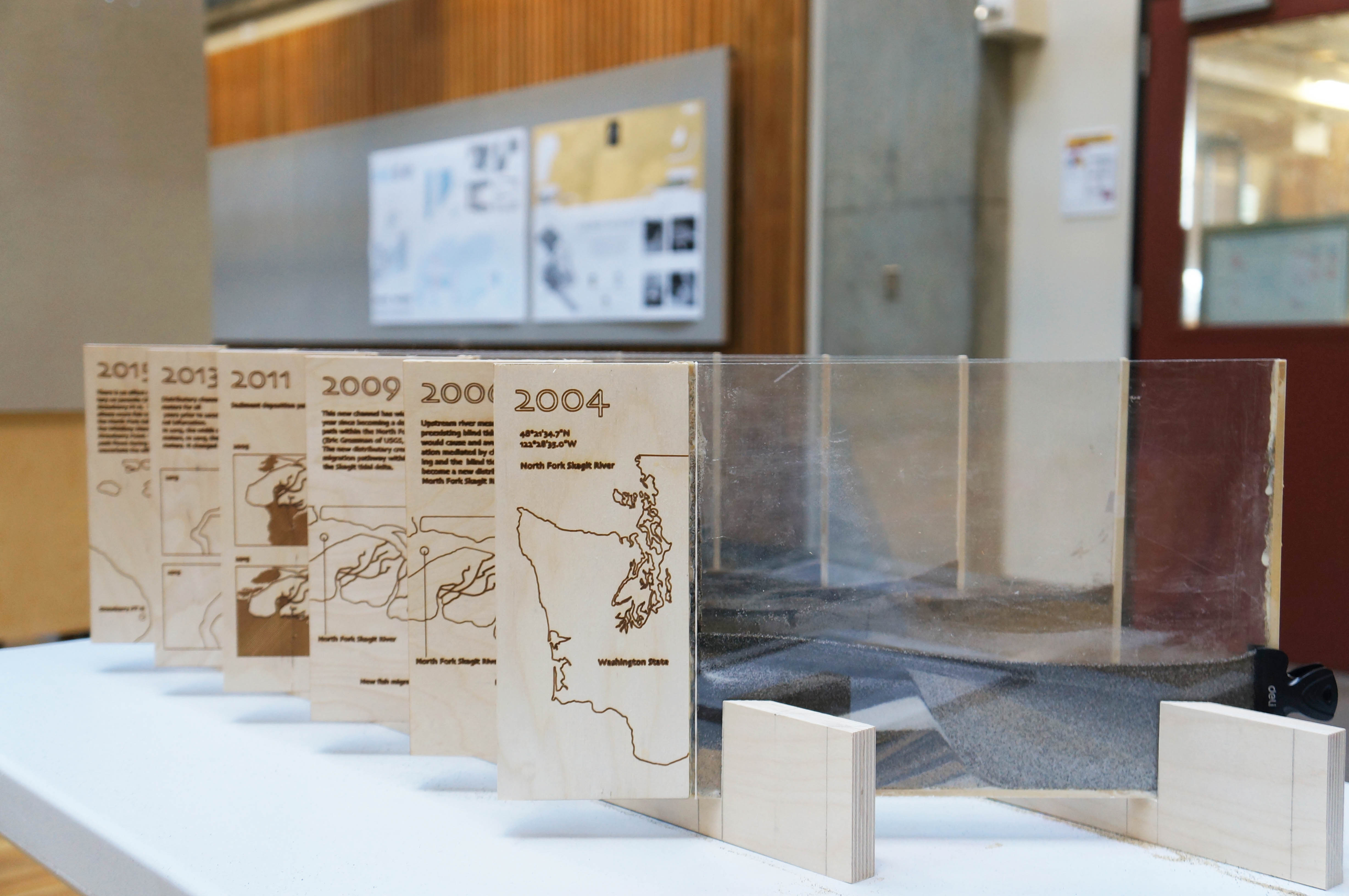
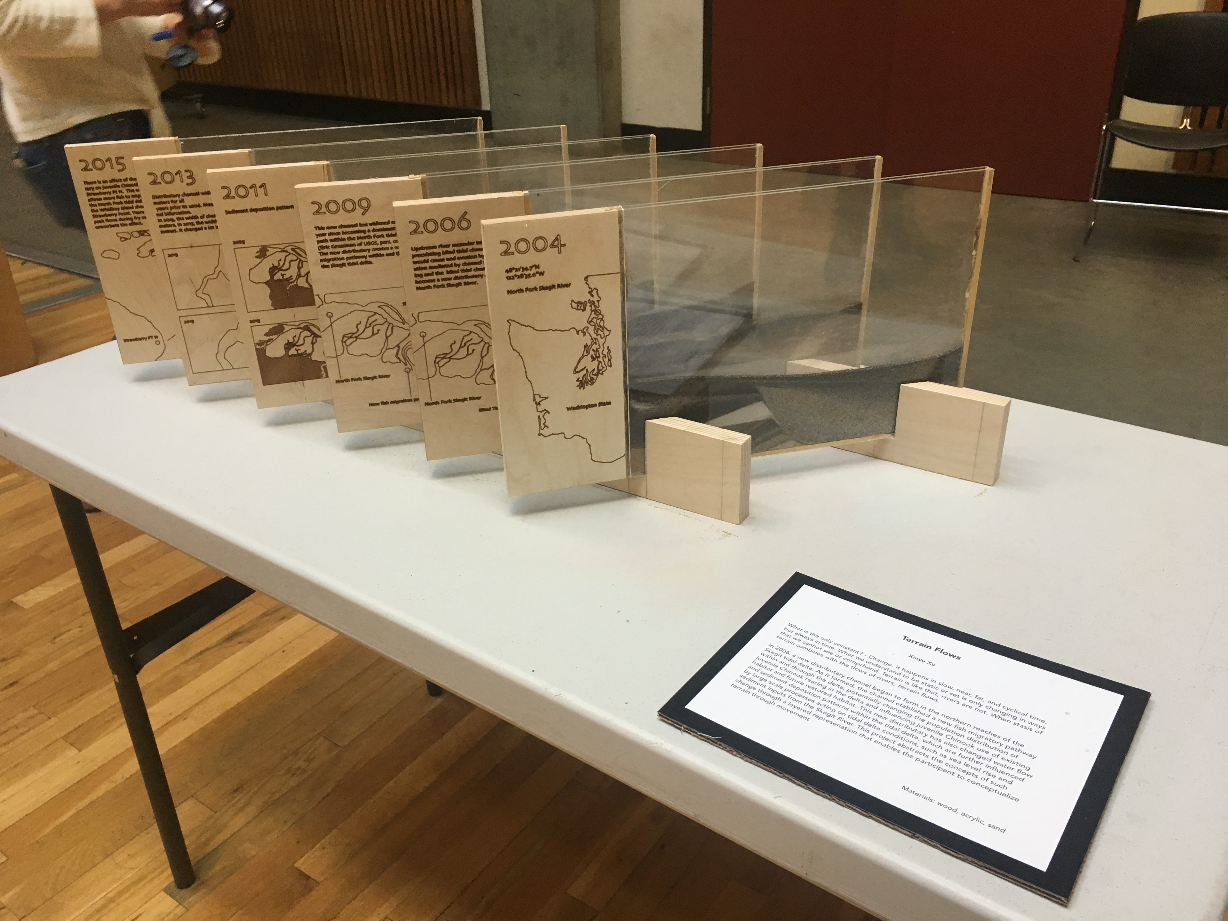
What is the only constant? – Change. It happens slow, near, far, and cyclical time, but always in time. What we understand to be static or set is only changing in ways that we cannot see or comprehend. Terrian is like that, rivers are not. When stasis of terrain with the flows of rivers, terrain flows.
In 2006, a new distributary channel began to form in the northern reaches of the Skagit tidal delta. As it formed, the channel established a new fish migratory pathway within and through the delta, potentially changing the population distribution of juvenile Chinook rearing in the delta and influencing juvenile Chinook use of existing habitat and future restored habitat. This new distributary has also changed water flow and sediment deposition patterns within the tidal delta, which are further influenced by large scale processes acting on tidal delta conditions, such as sea level rise and sediment inputs from the Skagit River. This project abstracts the concepts of such change through a layered representation that enables the participant to conceptualize terrain through movement.
materials: wood, acrylic, sand